
Gear
Gear & food
Ultralight gear for long-distance hiking
Everything I carried on the Te Araroa, the Pacific Crest Trail, the Tour du Mont Blanc and the Pyrenean Haute Route, with weights, tips and what I would change.
Gear lists
Four trails, four lists
Each list contains every item with its weight in a table, plus trail-specific advice and answers to the most common questions.

PCT gear list
4.9 kgbase weight- Backpack: Hyperlite Mountain Gear 2400 Southwest
- Tent: Zpacks Duplex
- Sleeping bag: Western Mountaineering Summerlite

Te Araroa gear list
16 → 5 kgbase weight from start to finish- Backpack: Hyperlite Mountain Gear 2400 Southwest
- Tent: Zpacks Duplex
- Rain: Rain jacket + Zpacks rain kilt

TMB gear list
4.8 kgbase weight, full circuit in 4 days- Style: 4 days, wild-camping every night
- Backpack: Hyperlite Mountain Gear 2400 Southwest
- Tent: Zpacks Duplex

HRP gear list
4.8 kgbase weight, wild-camping every night- Backpack: Hyperlite Mountain Gear 2400 Southwest
- Tent: Zpacks Solplex
- Stove: Jetboil Zip
Know-how
Tips, resupply and food
What the gear lists don't tell you: resupply strategy, food, cameras and the small things that make a long hike easier.

My 11 “unusual” tips for a long distance hike.

My re-supply strategy for the PCT

Follow up on re-supply, food, camera and blogging questions on the PCT. Questions from the readers…

Queenstown – first gear review on the Te Araroa

Preparation for the PCT – some of my new toys…

5.000km, ripped and reborn – the pinks shorts are back alive!
More
Gear stories from the trail
Gear changes, repairs and reviews along the way.


PCT Side Trip: Climbing Mt. Rainier (14,410ft / 4,392m)
We just made it on time. Arrived at 1.30 in Ashford. That gave us 1.5h for a desperately needed shower after 10 days, a laundry run, pick up of our rental gear and some quick food before the briefing started. We were only three minutes late. 💪 Rental gear? Of course we are not prepared for anything up there with our tiny little ultra light packs for hiking. So we had to get boots, crampons, gaiters, helmets, gloves, harnesses, thick down jackets, avalanche transceivers and so on.
What brings us here? As if the day in day out walking on the PCT wasn't already enough we had signed up for a summit attempt on Mt. Rainier. Why? Well, we have seen and walked around the mountain for many days now and we just couldn't resist. Kaylee had never climbed a mountain and I am fascinated by them anyways. We had talked about it earlier already but ditched the plan for various reasons. But standing in front of it changed the plan again. And now we are here! Lucky as ...! We managed to get two more spots in an RMI trip which also solved the problem with the permits you need. Ready to Rock'n'Roll 😎
And then the briefing with Tyler started. He gave us a quick introduction of what we had to expect during the next days. A gear check later we were released for the day.
We got some funny looks during the breakfast the next morning when I ordered a bagel with cream cheese, two waffles with whipped cream and straw- and blackberries, Greek yogurt with blueberries, milk, orange juice and coffee. Well, for us it was still a "town day" which meant: eating!
We left for Paradise Valley - our playground for today. This day was dedicated to the mountaineering school. An introduction for the Padawans and a refresher for the Jedis in the group. A good session and great fun to slide around in the snow for the self-arrest training. We were also lucky of being in a fun, fit and excited group - or how Tyler called us: "gang".


And on the next day (of course after another gigantic breakfast) we left at 8.15am for the real journey. It was still pretty smokey and clouds on top. Not the best conditions to climb for views... Guess who we got greated by on our first days.

After about an hour of hiking up the paved sidewalks of the park we hit the snow field which would bring us up to our rest stop at Camp Muir. The pace was nice and easy. I guess Kaylee and I are also in the best shape of our life for this kind of hike - used to walking for 12-14h, carrying a more or less heavy pack and also still some altitude acclimation help a lot now!


Early afternoon we made it to Camp Muir. A few little shelters with bunk beds and toilets. This is where we would hang out and rest for the next few hours.


As for most climbs in our latitude you go to bed early and rest until you start the hike in the middle of the night to get on the top for sunrise and back down before the snow gets to slushy and dangerous. So you try to sleep which usually doesn't work since you are not tired, to excited or somebody always snorres in these huts as well... Wake up call at 12am and start of the hike one hour later. We all got ready and geared up with harnesses, crampons, headlamps and our pack for the night with snacks and a few more layers. And then the adventure began. A smooth traverse over a flat glacier, through Cathedral Gap onto the Ingraham Glacier, traversing below its massive ice fall and up Disappointment Cleaver on loose rocks back into the glacier which was just an endless sea of penitentes (spiky ice formations). The smoke had almost disappeared but clouds had pushed in a bit so the view was limited. Also the drill in the climbing teams was pretty strict and no time for breaks other than the three major ones on the way up. The weather forecast had a chance of rain and thunderstorms in the early afternoon so especially the guides wanted to get up and down as fast as they could. So no Fotos on the way up besides a few during the break. Mountain artwork 😉


Close to the top on the crater rim the ice disappeared and it flattened out a bit. Safe to take the camera out.

As you can see - you can't see anything 😂 We were in the middle of ancloud which had formed on the peak. Not the nicest thing after working hard to get up here. But it is what it is. The wind was chilly on the rim so we dropped down in the crater to put a layer on, take a break and celebrate a bit. The obligatory peak photo (yes, this could have also been taken somewhere on sea level in a backyard 😂)


It was so wet and cold in the cloud that my face-marmot got a bit of a frost bite...

At 7.15 we left the peak again after we had spent maybe 10 minutes up there. No reason to stay longer with 0 visibility. So down again on the same route. Only difference was that we could see a bit more now. Luckily the cloud only covered the top but a few hundred feet lower the visibility improved.
One of the trickier parts in the steep and crevassed section of the glacier. A fixed ladder had been installed to cross the crevasse safely.

Through the huge field of penitentes.


Down Disappointment Cleaver and back onto the Ingraham Glacier.


One of the more dangerous sections on the route - the ice fall. The glacier is pretty steep here and the ice is broken up pretty heavily leading to overhanging ice formations. The worst accident in Mt Rainiers climbing history had happened right here when an ice avalanche buried several climbers. The warmer it gets and the more the ice is moving the higher the risk of ice falling out of "place". So something you want to leave behind you as quick as possible and look at it from a distance...

Our guiding dream team at our last break before we started the last section back to Camp Muir.

In day and sun light we could finally see the entire beauty of the glaciers and crevasses. So beautiful. Now with almost no snow left you the bare ice sticking out almost everywhere.

p9082675.jpg
Back in the camp at 11am - 10h after we left in the middle of the night. We packed our stuff, ate and drank a bit and set off for the last 2.5 hours down over the snow field. Sliding, glissading down the hill is soooo much fun. And again we were proven wrong. Did Kaylee and I think that Sonora Pass was the last glissade of the PCT we had to learn better.

The further we did get down the better the weather turned. Blue sky above us, no more clouds or smoke. Apparently this is where we stood on top of a few hours ago 😳

Final photo of the climbing crew - happy and tired.

A few more steps down to the toad where we got picked up again. What a trip. I know I am repeating myself. But it is what it is. I love mountains and everything connected to them. Not that it was my most challenging climb so for nor that the weather was great on the top but just being on a mountain just feels good. Every time.
Kallie, one of our climbing partners coincidentally lives 10 minutes away from my friends Jeremy & Anna who we will spend the weekend with now in Seattle. So she gave us a lift and dropped us off. Time to celebrate 🍻

PCT #112, 1204mi: A hero day through Sierra City, an epic climb and just a great day!
We managed to leave on time today and had already 9 miles in at 9 o'clock 😎 The cool thing about getting up early:

Everything looked like another day in the forest to Sierra City - our resupply point for the next 3 days. We dropped down from 8,000ft to 4,600ft. The lowest we have been since we got back to the Sierras and rolled into town before 12 o'clock. Just before we reached the highway the Sierra Buttes revieled our task for the afternoon right in front of us - you can see the switchbacks on the left hand side of the mountain:

Ice cream & soda later we picked up our supplies and moved to the restaurant for dinner. A very chilled time since there was no cell phone reception and nothing to do at all. On our way from the grocery store to the reataurant (about 300ft) a woman came running out of her bakery waving cookies at us - with M&M's on them... 😳 "They are for you!!" #happyhikers
While we were at lunch a thunder cell passed over the city and the trail
ahead of us. But as soon as we were ready to leave the worst had gone through and the sky turned bright again. Great benefit - the temperature had dropped significantly which was great for our climb. Left town after three ours. Probably record for a town including shopping. A real hero day.
Zero day: A full day in town
Nero day: Either a short day in or out of town where you will stay or have stayed the nigt with less than 10 miles of hiking
Hero day: Going in town (eat, resupply, etc.) and leave same day again
And than the climb. Probably one of the coolest outside of the Sierras. Almost 3,000ft in one go. But it was a pretty steep wall in which we switchbacked and traversed.


The photographer student 😋 also did some shots today. So good since there are also pictures of me on the trail now.

We put another 8 miles in - all uphill in that one climb giving us 25 miles total today. We rock! What a day. And as a treat on top we got this dinner & camp spot tonight. #ridgelive


PCT #63, 1517mi: Getting up from two town days and getting back into the mountains. Finally! Best day of the last 2 weeks!
Our rest day in Mt. Shasta expanded to solid 2.5 day break. Why? Many reasons. On the one hand side you have a lot of chores to take care of when you are in town and secondly we were also surprisingly sore from the last stretch. Haven't been so stiff and sore on the entire trail so far. But also no clue where it came from. Maybe the last weeks of slower pace and less miles actually gnawed on my fitness level... 😳
So what did we do? Besides the normal chores of buying food and sorting that out for the next stretch...


... we also just hung out a bit. There was a nice park behind the post office where we chilled quite a bit. And since Mt Shasta is a full on hippie town no one really took notice of people laying around in the park. We were probably still rather on the touristy side with our hiker outfits compared to the community around us 😂🙊.

I also tried to find an alternative to my orthotics. And I found something promising. After cutting and adjusting them I do hope that they will do the same job until I find an orthotic to get me new ones...

A very sad part was to say good bye to two of my favourite pieces of gear... 😔
My Icebreaker t-shirt with the 7 summits (the best design ever made) and my grey long sleeve were way over their time of duty now. I prolonged the usage as much as I could - but now I had to face reality. They just did not do what they were originally designed for. My grey long sleeve had served me several years now. It was hard to leave them behind. It is strange but similar to the shoes you create a strong bond to your gear. It keep you warm, dry or whatever it is designed for and also serves in many other functions in the trail. They just become very important and a part of the story. That's why it's hard to leave them behind when they have given everything in their power to help you get so far... R.I.P. Thank you for being such loyal companions!


What else? Right, the thing with the water. On the second day we had to find these signed everywhere in town. What a luck! But at least we were not drinking from the streams at the moment. I hadn't filtered my water in the last two weeks apart from a couple situations... 😳

Kaylee's and my ice axes have been lost in the US Postal Service since two weeks so we had to buy new ones! That of course sucks! Luckily the gear shop in town was so kind to sell us a couple old rental one for 35$. Still sucks since we had only used the axes for a week or so...
And then it was time to head out again. Morning chores and back on the trail per hitch hike. We got a ride in two cars at the same time. And then something beautiful happened. Guess what? We are back in the mountains. After the last two weeks mainly in the forest we came out of the trees to be in the middle of my favourite scenery - the rough and scrubby alpine terrain! I could not stop smiling! Again - here it is. The realisation how much I love the mountains. #ilovemountains


We climbed for over 4,000ft to find these epic views over Mt Shasta and the valleys. I guess not much I have to say though...


And then one of the most epic camp spots on the trail for us! We all decided to cowboy camp tonight. Can't wait for the stars...


Antarctica 5: Saying good bye to South Georgia and heading towards Antarctica
On the next day our goal was to land on Ocean Harbour early in the morning and then to continue to St. Andrews Bay to visit the largest King Penguin colony. But when we arrived the swell was just too strong to even get the zodiacs from the ship into the water. So we continued further on to the Royal Bay. Also here we couldn’t attempt a landing but the views were just spectacular. And probably the views from the boat were even better than from one of the beaches.
There was still snow on the mountains and it’s funny to see how the relevant difference in temperature must have been just less than a hundred meters. The weather was nice, the sun was out but the swell still to high for a landing. So we just anchored in the bay for a little while and enjoyed.


The picture of the island changed a bit. It felt like a few more mountains and rougher terrain. But this could have been influenced by the snow and low hanging clouds as well. The game of light, reflection and colour was just astonishing!


And one of my favourites. Probably because #ilovemountains I am a bit subjective on this one. But I love the beauty of this one. Reminds me a bit on the Matterhorn.

A few more impressions from the coast line on our way to the southern tip of South Georgia.


And then we entered the Drygalski Fjord - the last fjord on the southern tip and probably the most narrow one. The clouds pushed in a gain and were quite low which gave this really mystic atmosphere in the fjord. Also the glacial ice and melted water which feeds the fjord gives it this unique colour. We went all the way in with the Plancius to were the Risting Glacier calved into the fjord. Even a couple of hundred meters away from the glacier the fjord was still 240 meters deep. You can see how the radar on the lower right corner pics up the edges of the fjord and the beginning of the glacier.


On the way back from the way back out I was able to capture this beautiful Blue Eyed Comoran.

You can tell that it is getting colder and rougher. More and more glaciers reach directly into the sea. Even though even these glaciers are all shrinking in a shocking speed.


After lunch we went for a zodiac ride into a side arm of the fjord called Larsen Harbour. We spotted a few Weddell Seals which are quite uncommon so far up north and usually are only found on the Antarctic Peninsula. And of course the side arm has also been formed by a glacier which now reaches and floats on the sea.

As you can see the there are a few lines on the upper part of the middle blue section of the glacier. They look like stripes which curve down from the left upper part to a little low point in the middle. This is because the flow rate of glaciers is always the fastest in the middle on the top. Why? The viscosity of ice on ice is usually a lot higher than when ice has to go over rocks. Here also uneven ground slows the glacier down which makes it go faster in the middle and slower in the outskirts. Therefore also sediments which have deposited at the same time will flow faster in the middle and create these curved lines.
And then it was time to go leave South Georgia. I can only say it again - everybody said beforehand it is a special place and I can only agree. It is! The massive amount of penguins especially and these beautiful mountains embedded in this rough environment. It’s the stuff you usually only see in these documentaries which look like from a different planet. It again reminded me on how important it is to safeguard these last remaining hot spots on the planet.

So we set off sailing again with course south-west to the South Orkneys. A one and a half day sail. The first outskirts of the Antarctic. We had just passed the Cape Disappointment when two amazing Fin Whales which are the second largest whales in the world came up close to inspect the boat while they were hunting krill. You could even see the red krill clouds in the water around us. The two whales came to about 10 meters to our boat dived underneath it a few times and just checked us out. It felt like they came to say good bye and wish us a good journey. Thank you South Georgia for this wonderful experience!


Continue with part 6

Huayna Potosi - 6.088m. A tough climb and “super-espectacular” views.
I actually wanted to cross the Cordillera Real from north to south but during the rainy season there was no guide willing to go. And also the guides did not want to go on a 10 day hike without mules which would carry their food. Lazy ones! Going without a guide during the rainy season with high rivers and snow would have required a proper research and a decent amount of preparation. So I decided to just climb one of the higher mountains and enjoy the view from above.
We drove from La Paz to the Base Camp at 4.700 where we stopped for a quick lunch. You normally have the option of a three or two day tour. The three day gives you one night in base camp and a bit more time to acclimatise to the altitude. I hoped that I was acclimatised enough to the La Paz level of 3.600m and since I haven’t really been affected by altitude sickness on all my trips I gave it a go in two days. Meaning that we left for High Camp after lunch. A nice and easy 500m climb though amazing landscape.


When we arrived at the High Camp after about 2h the camp was locked. Eulogio tried to find the key which apparently was always hidden underneath one of the rocks but no luck.

Luckily enough there was a second camp near by where we spotted people and so our guide negotiated for us to stay there instead. Good call - would have been way to ugly out there without a tent during the night. We had good company and after a dinner at five we all laid down to rest.
At 23.45h was wake up again and we got ready to leave. The night had been so and so. It was partly completely clear with amazing views of the stars and the peak and then an hour later it snowed again. We had heard from the groups that came down the morning we arrived that they all had to turn back because the avalanche danger was just to severe after a lot of new snow during the last days. So we were all worried a bit about more snow.
Anyways at around 01.00am we left. 20 minute of rock climbing before we put our crampons on and went on the glacier. And then a five hour hike over the glacier started. A lot of easy parts, some steeper ice climbing and a lot of switchbacks to get around the massive crevasses. Unfortunately we were just a bit too slow for me. I was last in our roped party and in order to keep the rope tight I could always only walk three to four steps before I had to stop and wait for a bit. With this stop and go I never got into a rhythm and I was also getting cold. And on top we got caught in between the other groups being even slower and taking a lot of breaks. The temperature dropped to around -10C and I was glad that the wind was not strong. The gloves i rented were crap and my fingers were gone after about three hours.

And then at around 6.00am it was getting lighter and lighter and you could see the sunrise below the cloud layer which was probably 1000m below us. An amazing play. We were stuck again probably 70m away from the peak on a very steep slope. One group tried to make its way up the last bit through a very steep section and everybody had to wait again. I was to cold and to afraid to slip to take my camera out of my backpack to take pictures. After about 30 minutes of waiting our guide decided to turn around since he saw the other group struggling. It was a lot of fresh snow and therefore it was impossible to find proper ice to put ice screws in to secure us from a slip. He said we would take an alternative route. We therefore climbed down again for a bit - how painful since you just pushed yourself up and you knew you had to go it up again at one point of time. The views though were getting better and better.

We traversed over a flat part of the glacier which was full of big and small crevasses which you could very often identify by the sunken in snow bridges. The snow became deeper and softer - not a good sign if you have to cross crevasses. So we debated a few times if we should just call it a day. It was already 7am and the sun was getting stronger and stronger. We continued. After we had crossed the field we traversed of a narrow ridge to a little chimney. The snow was know waist-deep and soft. So the ice axe had no grip any more and we barely made any progress. It was tough! When we made it to the final ridge the snow became harder again - which was good. Both sides of the ridge were steep and the one to our right between 70 and 90 degrees steep and looking down we couldn’t even see the end.


At around 7.40h we finally made it to the top! A little ice knob was the highest point of the ridge an we climbed it one by one.


Amazing views from the top. We took five minutes to enjoy but then made our way back, I was seriously concerned about the sun heating up the snow and melting our snow bridges on the way back. So only quick pictures and back.


The field we had to cross and which worried me a bit.

On the way down I stepped into on hole and slid down but thanks to being roped my slide stopped after a few meters. We were all getting tired and my climbing partner David also suffered from the altitude, exhaustion and some nasty blisters. But we pushed on until we safely crossed the field.

We pushed on and tried to get down as quick as possible. First in the sun.


Down the steep section again.

And then we entered the clouds. After about 1.45h we were safely back in High Camp and after a quick soup and packing up we mad our way down to Base Camp again.

What can I say. The way up was sometimes a bit frustrating and showed me again how much I love to go my own pace in the mountains. The ridge climb was tough and beautiful at the same time. Even tough I jelled a few times - that's part of the game: no pain, no gain. Great to have been back on a proper glacier, mountain and ridge! 🤘

Cerro Chirripó - the highest mountain in Costa Rica and a hike to pure happiness. #ilovemountains
After all of the sitting in the last weeks I could feel the need to get outside again and to exercise a bit. I also needed some time for myself and what else could be better than a high mountain for that. After checking the weather forecast for the weekend I found a little rain hole on Friday and Saturday and therefore decided to skip classes on Friday and head off to the mountains. My destination: Cerro Chirripó. With 3.820m / 12,533ft the highest mountain in Costa Rica with the chance to see the Pacific and Atlantic Ocean from the top at the same time.
Unfortunately it was all a bit complicated to obtain a permit for the park which is restricted to about 50 people per day so I one of the staff members in the school had to help me do all the bookings. When ran out of school after class on Thursday at 2pm I had a few print outs with names, reservation codes, instructions in Spanish which I unfortunately did not fully understand. When it comes to directions (remember, no street names in Costa Rica) and changing buses etc. also the details can be important. Anyways what I knew was that my last bus with which I would make it to my final destination San Gerado left at 3.30pm in San Jose and my notes said that a lady named Laura would pick me up at the bus station. Well, I thought: She’ll be right, brew! 😂

After some running, endless hours in a bus which is not build for people with 1,90m in height, waiting and more bus rides I finally arrived in San Gerado at around 9 o’clock. And - no surprise a lady Laura was waiting for me to pick me up and give me a lift to my hostel. In case you ever want to climb Cerro Chirripó, her hostel "Cabaña Mis Ojos" is very unique in style and amazing!
A good night of sleep and a bit of paper work with the park administration in the morning and I was good to go. Normally people are advised to start at around 5.30 to 6.00am in the morning with the hike up to to Refugio on 3.400m. The trailhead is situated at around 1.400m so there are serious 2.000m of altitude to overcome in about 14km which results in an average of 6-9h of hiking. It is not really recommended to walk at night since you are passing through the thick rainforest for the first part which means spiders, snakes, jaguars, cougars and more. But I figured 14km couldn’t be so bad to not make it with a start at 9 o’clock.
So off I went. Immediately after walking the first couple kilometres I could sense this feeling of happiness coming back. The first 20 minutes where sunny and hot before I entered the rainforest and the clouds.


The trail was good and the way I like it - natural, muddy and with a constant incline. The bird life in Costa Rica is amazing. I read somewhere that it hosts around 900 different species of birds. I stopped quite a few times to try to capture them.


And then I entered the magic cloud forest. For about two hours I didn’t get out of the clouds anymore. It was amazingly beautiful and mystical at the same time. Even though I really enjoy learning Spanish and Costa Rica - I felt like a dog that had been unleashed after a long time on a chain. There it was again that feeling of pure happiness. The slope was steady and with the altitude I gained I could feel it in my breath and legs.


Besides the photo breaks I of course - no surprise - more or less ran up the hill. For one reason because I was not sure how long it would take me and I didn’t want to run into the darkness, for another reason because I wanted enough time to rest in the Refugio before the night hike to the top but I guess also because I just needed to feel my body at its physical limit again. Once I passed around 2.800m I could slowly feel the effect of the altitude - not very strongly but noticeable.
It was a beautiful play of the clouds and the rainforest and I truly enjoyed the physical demand of the hike. The only breaks I took where photo breaks to capture some of the astonishing sceneries.


And then at around 3.200m the trail levelled off for the first time. Exactly when I reached the tree line. Have you ever been in mountains with a tree line of 3.200m? The European Alps usually have one around 1.800m and in New Zealand it even went down to 950m on the South Island. The vegetation changed completely to small bushes and many flowers. I spotted parrots, kolibris and many other birds.


The last bit was another 200m incline to the Refugio. I again tried to push it and had to take a couple of breaks. For the first time in a long time I actually had to stop on an uphill slope because I was out of breath. It was an amazing feeling and I couldn’t stop smiling. The mountain kicked my ass. I loved it. #ilovemountains Tough to explain but it gives me a feeling of being alive and it also grounds me.
I arrived at the Refugio and had a little break for lunch.


And then I explored the surroundings of the Refugio a bit. At 3.400m you are more than advised not to follow your bodies call and go for a nap but to walk around and massively hydrate to prevent symptoms of AMS (acute mountain sickness) caused by the altitudes reduced amount of oxygen. So I had a look at a famous rock formation called the Cerro Crestones and the evening clouds pushing in.


After dinner it was early bed time. I wanted to get up at 3am to arrive before sunrise on the top. It had cooled down noticeably during the night - the leaves were covered in ice and the ground was frozen. It was only another 400m in altitude and a bit more than 5km. Sunrise started at 5am so I had decided to leave at 3.30am to give me 1.5h - it resulted in a proper hiking speed. I have to admit I could definitely feel the altitude and also my legs from the day before. After the first half was completely flat the second half was steeper ending in a little scramble to the very top. I had to stop a few times to catch my breath, my legs tightened up and there it was again - this feeling of pure happiness. I reached the top at 4.45am, right in time for the sunrise. An amazing spectacle.


Ecstasy or the state of pure happiness
It is difficult to put into words what happens on hikes like this to me. But especially in the phases of physical limits as during this hike I very often move into a state of mind which is probably best described with a form of trance. I am fully in the here and yet and very often completely free of thoughts which is an amazing liberalisation. I guess it is a combination of the physical effort and the concentration necessary for each and every step (especially with trail runners) which does not leave a lot of room for more. I think I do shift from being “gone” completely to being completely and only perceptive for my surroundings. This is the only way how I can explain why I recognise many of the things which end up in some of the photos. I have talked about that a lot in amazingly inspiring conversations the last weeks with my friend Bri. It has been an amazing and enriching insight. She comes from what I call the "hocus-pocus world” (@Betty & Bri: forgive me… 😊) which consists of all these things as yoga, meditation, Ayurveda, chanting, crystals and much more which I can’t even spell - but for sure nothing which has been part of my life so far. But one thing I understood was that many of these “things”, especially meditation, are supposed to reach this state of clarity and presence in the here and yet without distraction. A lot of the rest is still complete “hocus-pocus” to me but I have to admit that once I enter this amazing state I can definitely sense an amazing flow of energy, clarity and presence. No matter what it is - I guess I still reside in the real world and being pragmatic - it is what gives me this feeling of unconditional happiness what somehow always draws me back into the mountains. It is tough to put in words but once you have experienced it once you want to have it more and more. I guess it is addictive. I slowly develop an understanding for all the people in the hocus-pocus world if that’s what they get out of their “things”…
@Betty: Would you have thought…? 😘
@NGT: No worries, I won’t convert (fully)! 😘
I think this picture from the top of Cerro Chirrió explains what I tried to describe - but way better than words can do.

I spent about an hour on the top to suck it all in. The sun rose slowly covering everything in a beautiful light. We had glimpses of the Pacific and the Caribic Ocean even though it was mostly covered beneath the clouds. Also an amazing shot of the Volcano Turrialba peaking out of the clouds with its constant fumarolic activity.


After a short look back on the peak during the decent I continued on my way back out. I stopped again for numerous photos and enjoyed the scenery with a few less clouds than on the way up which gave the trail a completely different look. I could feel my legs but what can I say - I was still completely high... 😊🤘


Thank you Cerro Chirripó for bringing this feeling back to me! More clarity what makes happy and the finding - more hiking and mountains in the next month. #ilovemountains.
Queenstown - first gear review on the Te Araroa
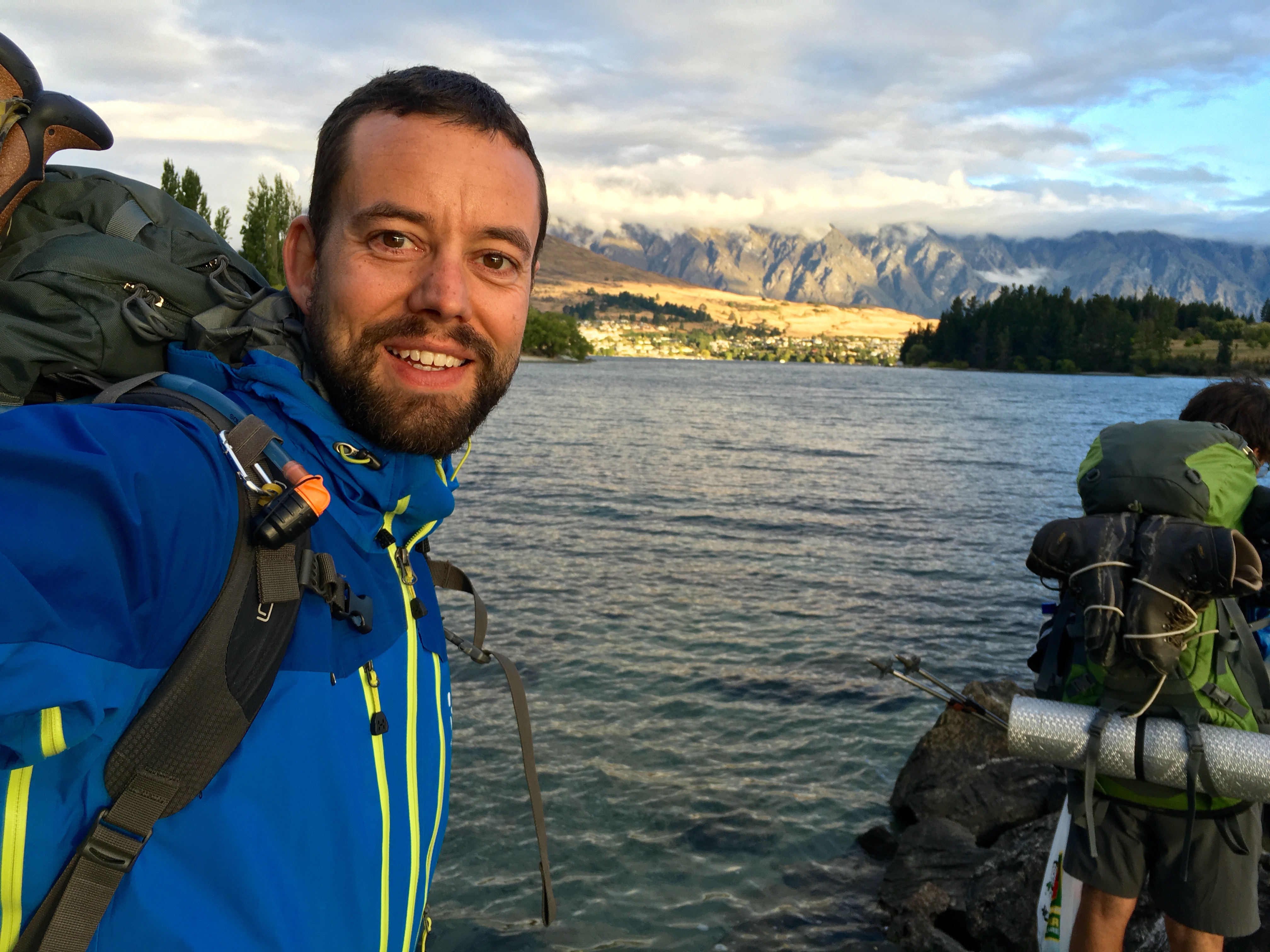
It was still raining in the morning when we left the campsite. So we had to pack a wet tent again ? Well, we hitchhiked into town and I first of all got myself an - as I thought - well deserved breakfast with omelettes, bagels and cappuccino! After that we had a quick stroll through town and I did an intensive research on the gear and possible replacements which took most of the afternoon. We still didn't have a room to stay since Queenstown was fully booked! But again luck and Kiwis turned it around for us: Hayden, Wayne and Dan who we met in the hut a couple of days ago offered us their couch for the night. So we stacked a few beers and had a nice evening chatting, watching "Cool Runnings" (can't believe that it was done in 1993 already!) and eventually a good sleep on the couch. The guys have a fantastic view over the bay...

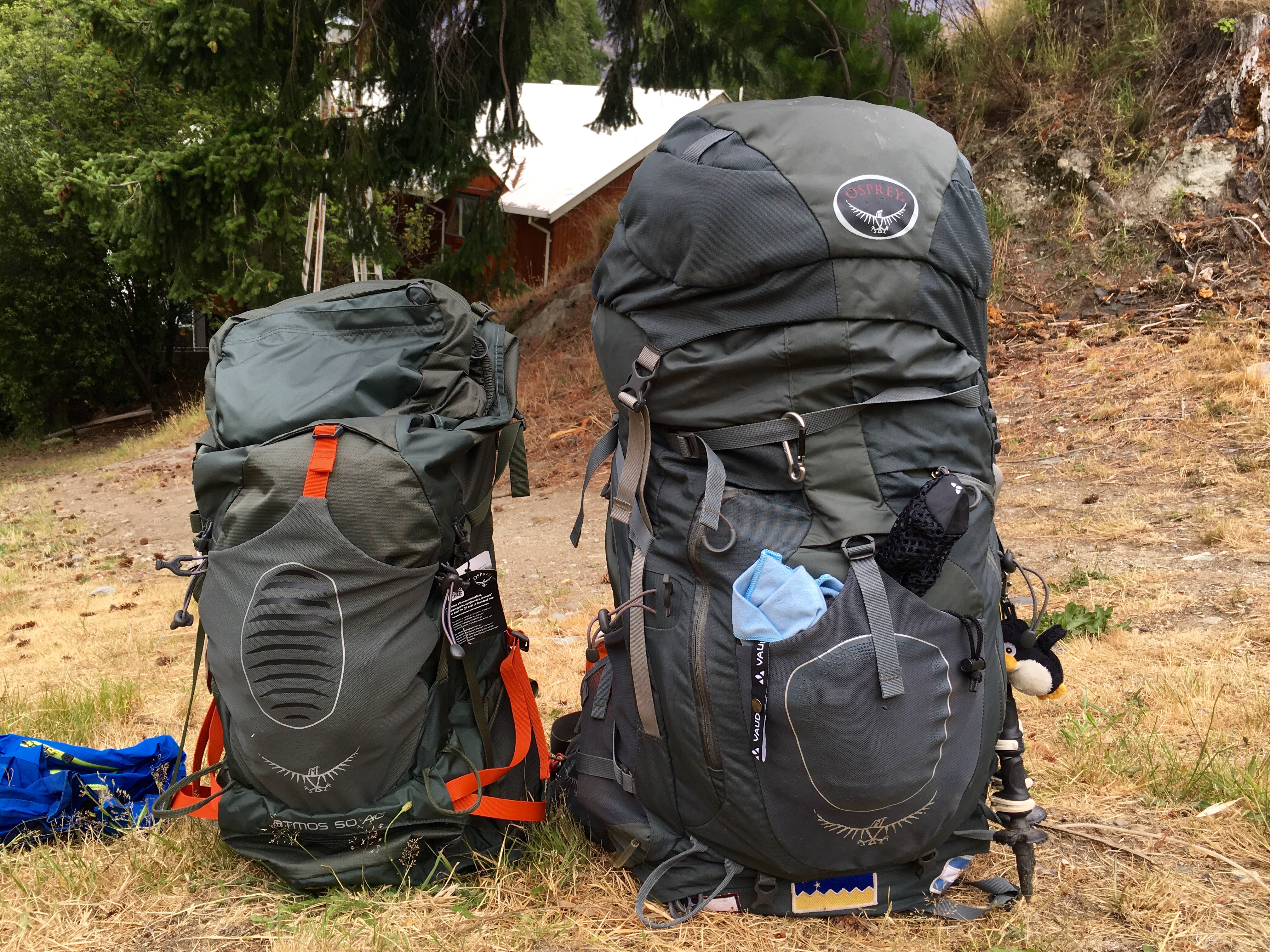
Next morning we hit the town and I finalised my gear shopping. I dropped my base weight without food and water below 10kg! I exchanged the tent saving 1.3kg, spirit burner and Trangia cooker for a small gas burner saving around 0.7kg, the new backpack saves around 0.8kg. The backpack was a tough one. I had to choose between a 44l which did not have a good harness/belt (1.1kg) and a 50l with a very good harness being 0.7kg heavier.
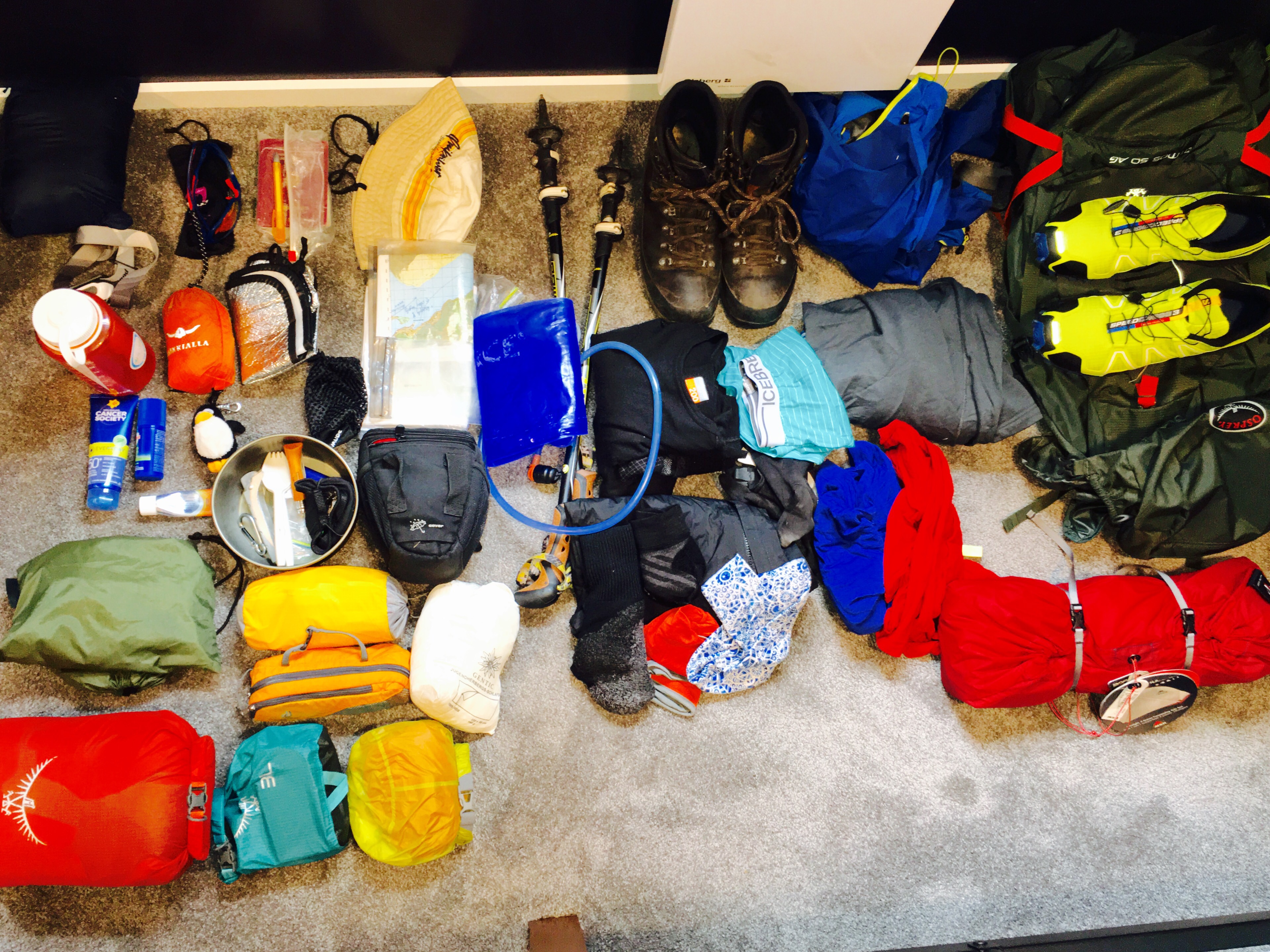 That's what's going to stay...
Considering the fact that I usually carry 1.5/2l water and around 750gr of food per day I usually do end up over 15kg at the beginning of a section. The longer sections even require food for up to 10 days resulting in almost 8kg food. The space in the 44l would have been enough probably but I ended up being a chicken going for the safe version ?
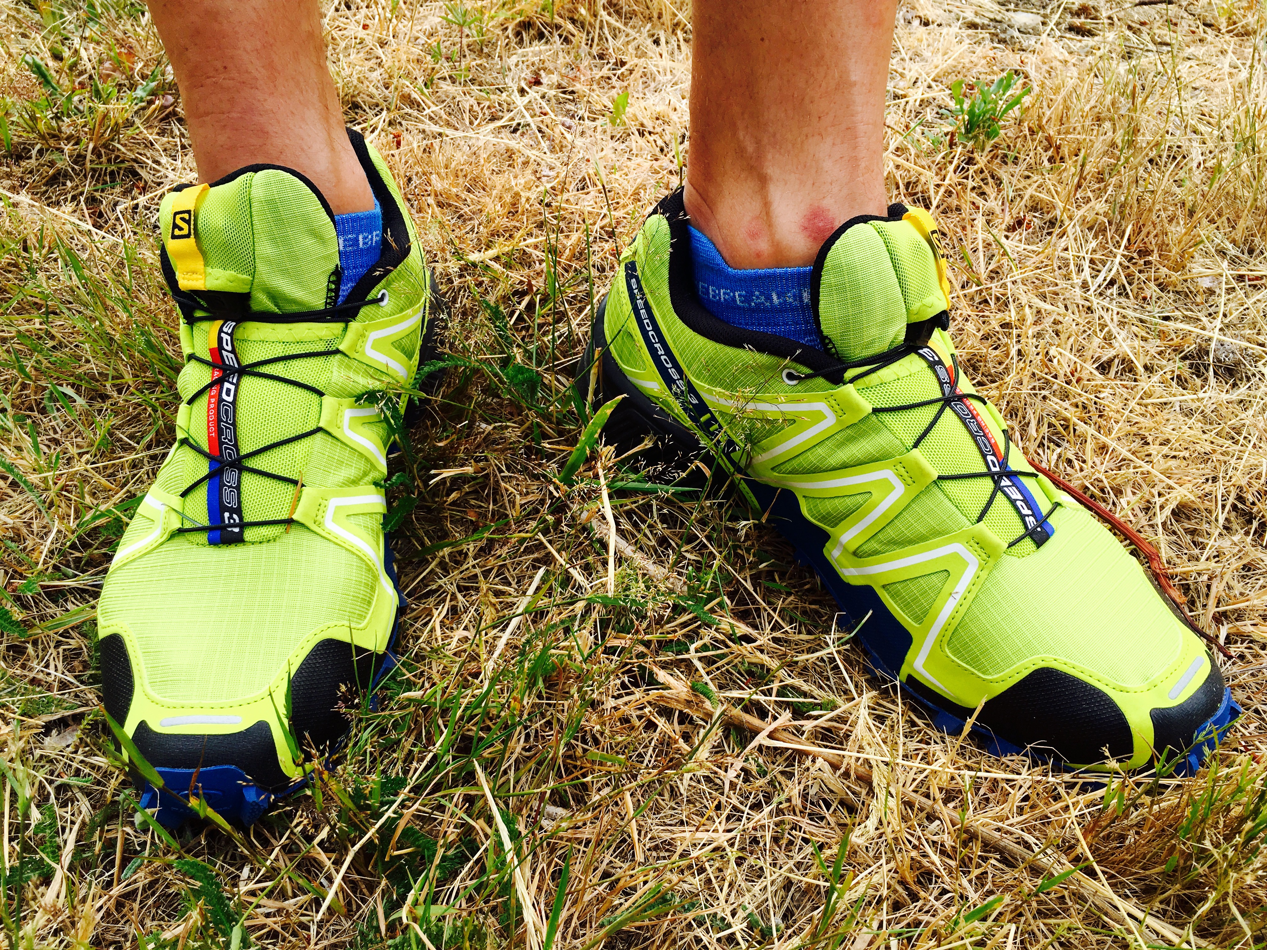
I also traded my sandals for runners which are more useful for the easy stretches and they also work for the river crossings since they dry quickly.
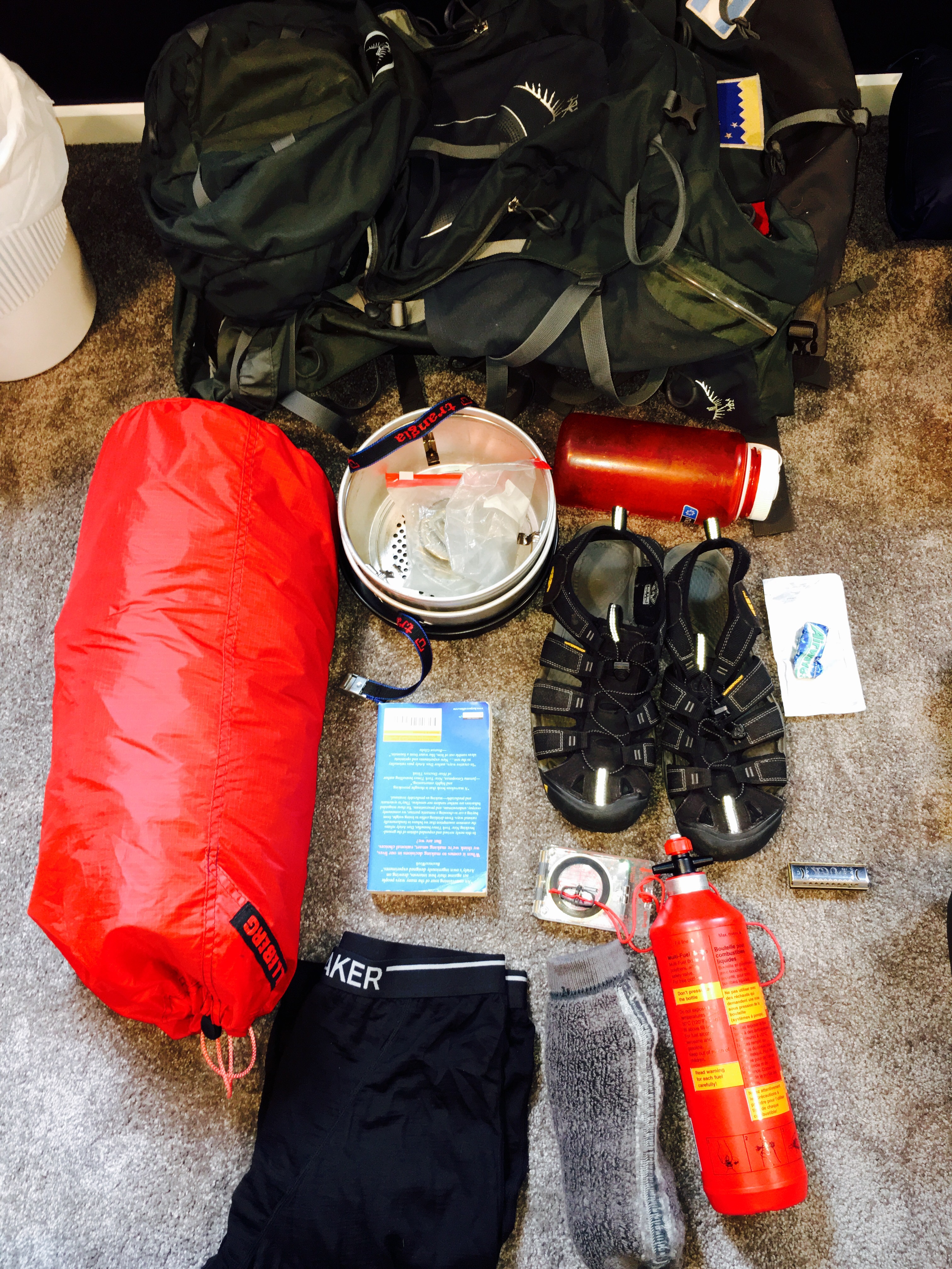
One pair of thick socks, long underwear, 2. compass, book, one water bottle and the harmonica (sorry Tasche - I started practising already but my skills are way to bad that I could use it in public. Some parts of Pipi Langstrumpf already work and I will take it up again after the hike!) will go to Auckland for now. Probably summing up to another 0.9kg.
That brings me almost to my desired 4kg.
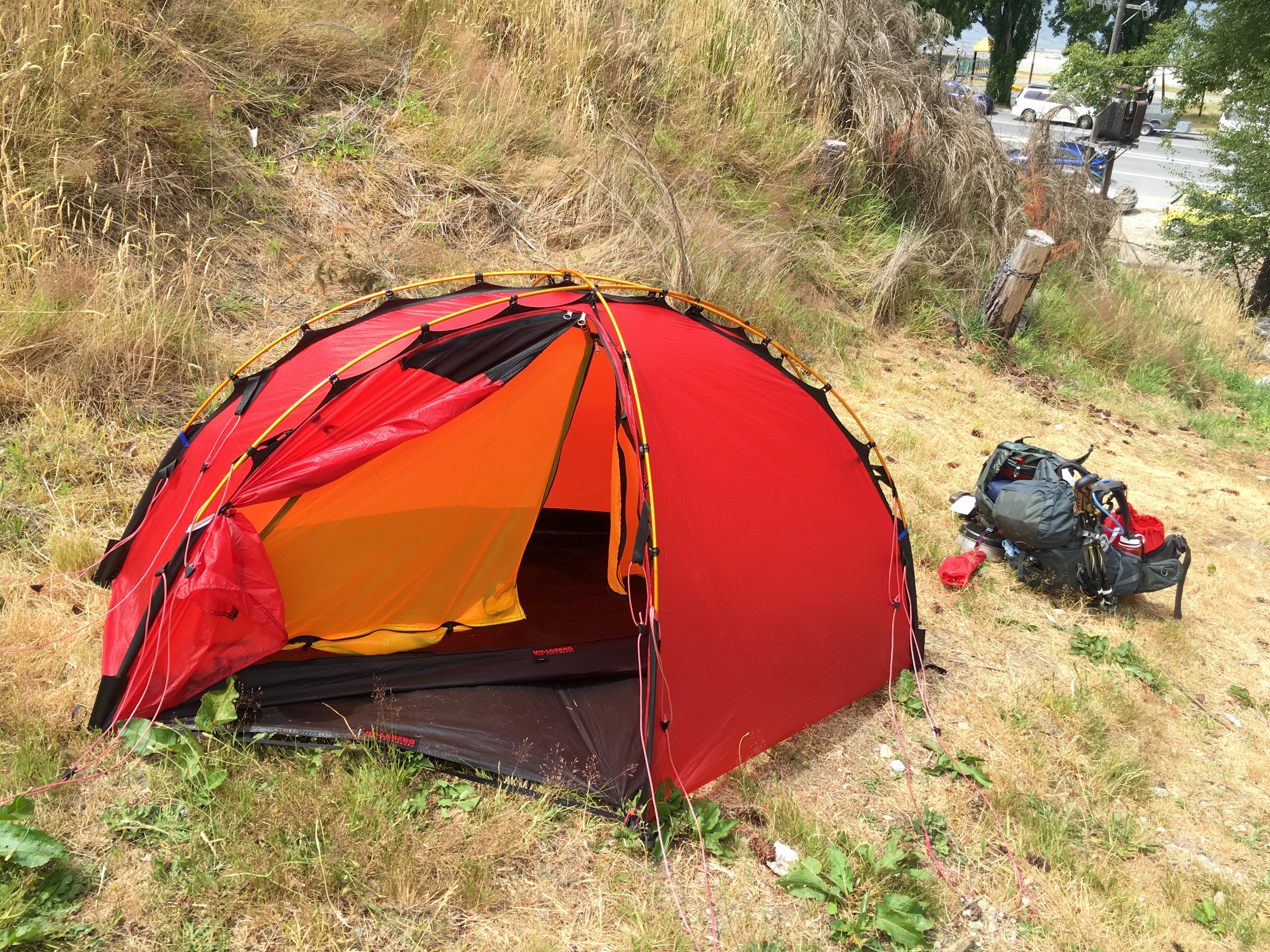
After the shopping part I went to my hostel, pitched my tent to dry it and sorted out the gear that I will send to Auckland now.
And finally I took the bus to Millbrook Golf Club to play my first round of ? in NZ!!!!

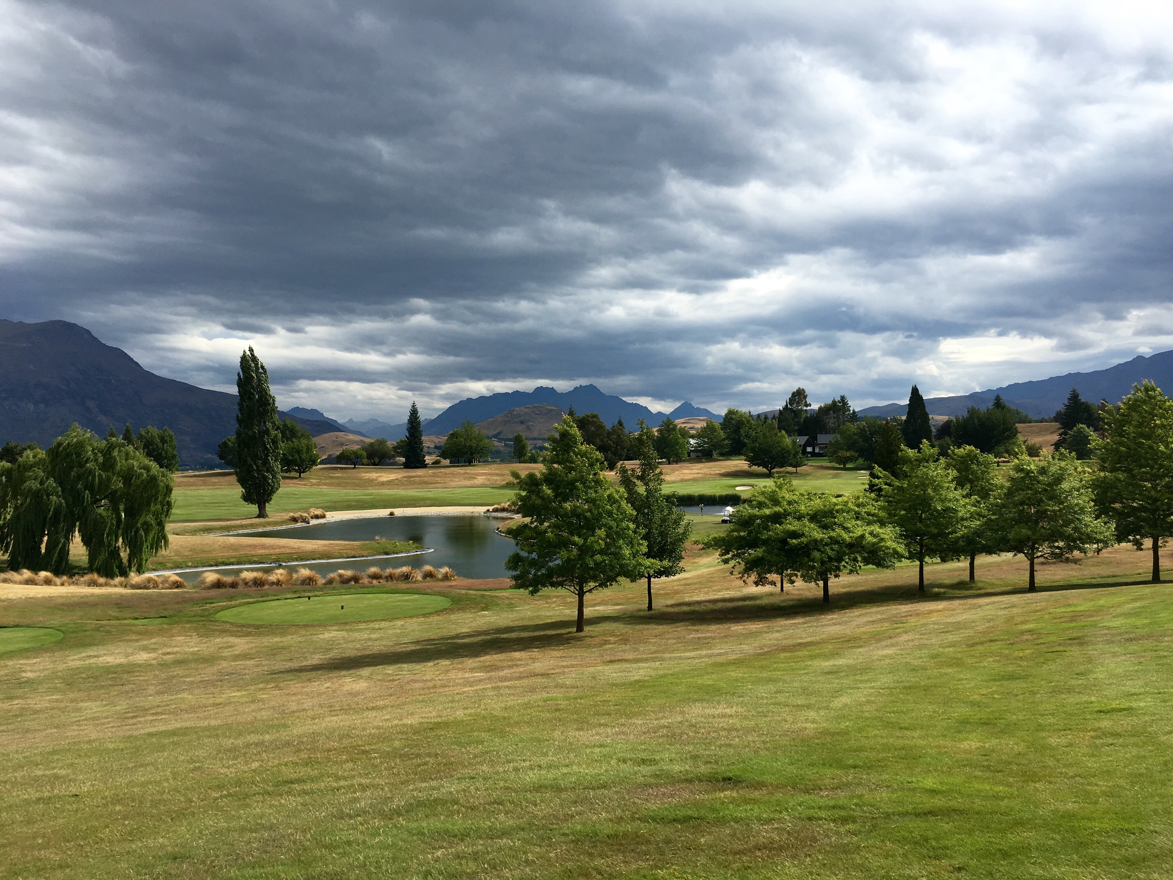
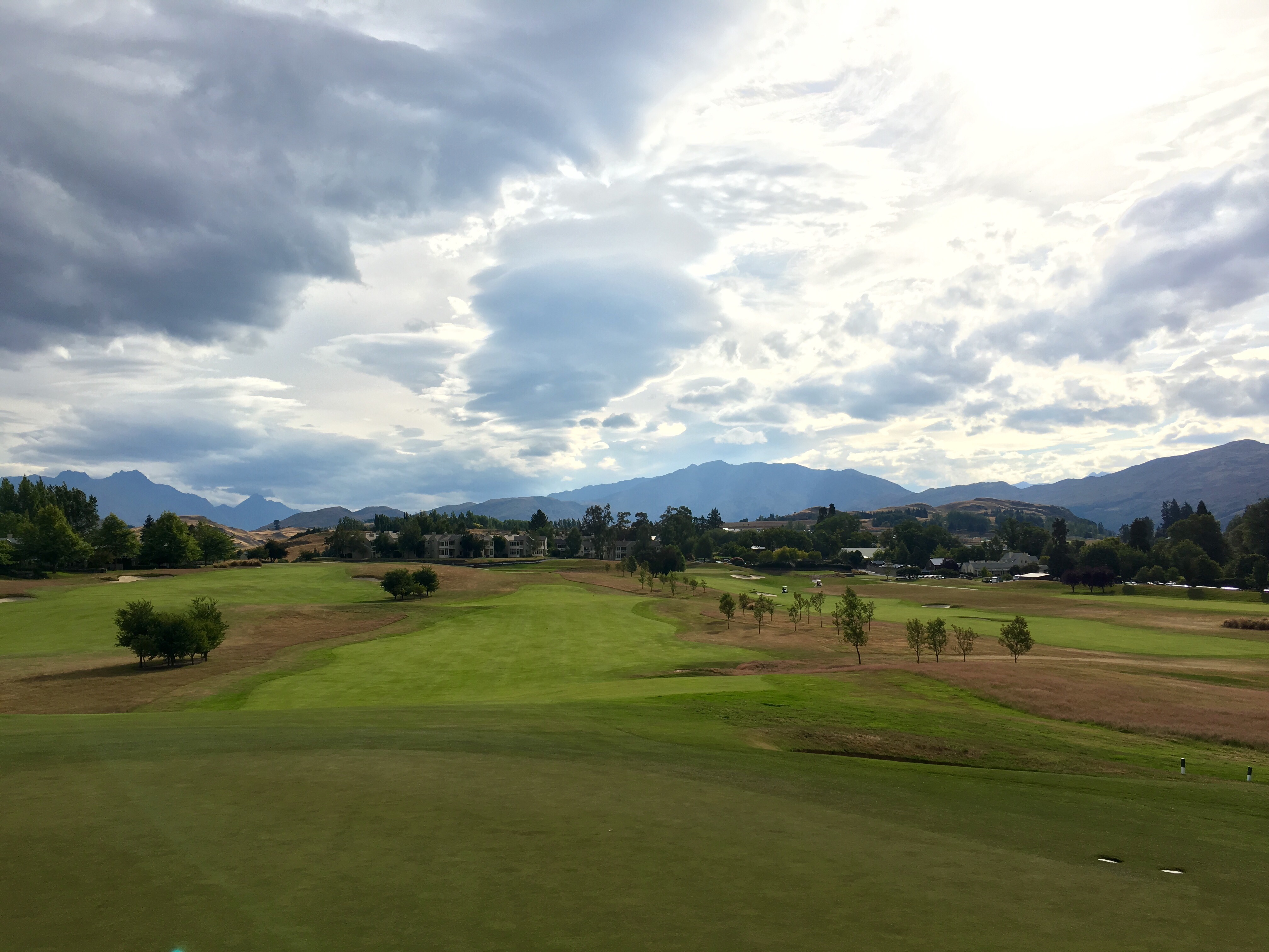
Didn't expect it to happen that early but jiehaaa! Millbrook also hosts the finals of the New Zealand Open - great course! Wayne and I took a cart and nice Taylormade (steel shaft / stiff - fully equipped!) rental clubs and off we went.
Balls went everywhere - left, right, long, short but better than expected including the entire range from birdies to multiple bogeys ? Anyways, great fun to beat the sh... out of the little white balls! I like!
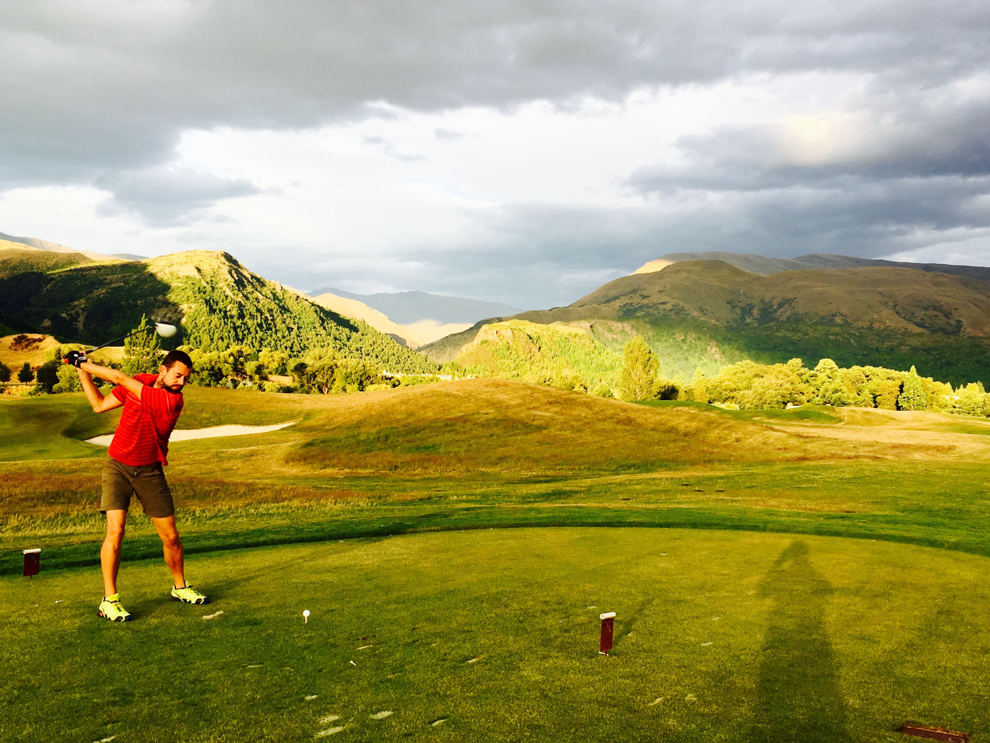

Guess it will not be the last round in NZ. Thanks Hayden for providing me the shirt! Of course I did not carry a shirt with collar the entire time just for this...
Quick dinner and a couple of beers with Ben afterwards before I went to bed.
This morning was laundry time. Having to wash everything and not having any spare cloth gives you quite a logistic challenge in a hostel if you want to do laundry... So I sneaked out at 6 in the morning with my blanket starting the washing and then waiting in my bed until I could go out again - naked and wrapped in my blanket - to put everything in the dryer. Story continues with the shower... Well, I will keep the details to myself ?
Sent off the package to Auckland and went to the doctor to get a prescription for contact lenses - first weird thing in NZ! Why do you need a prescription to buy contact lenses? Well, to cut a long story short - shop online and you don't need one. So I send it the pack to one of the cities I will pass through. Topic closed. ?
After that I took a ride on the gondola up to the local hill which was sponsored by Babs & Joern.
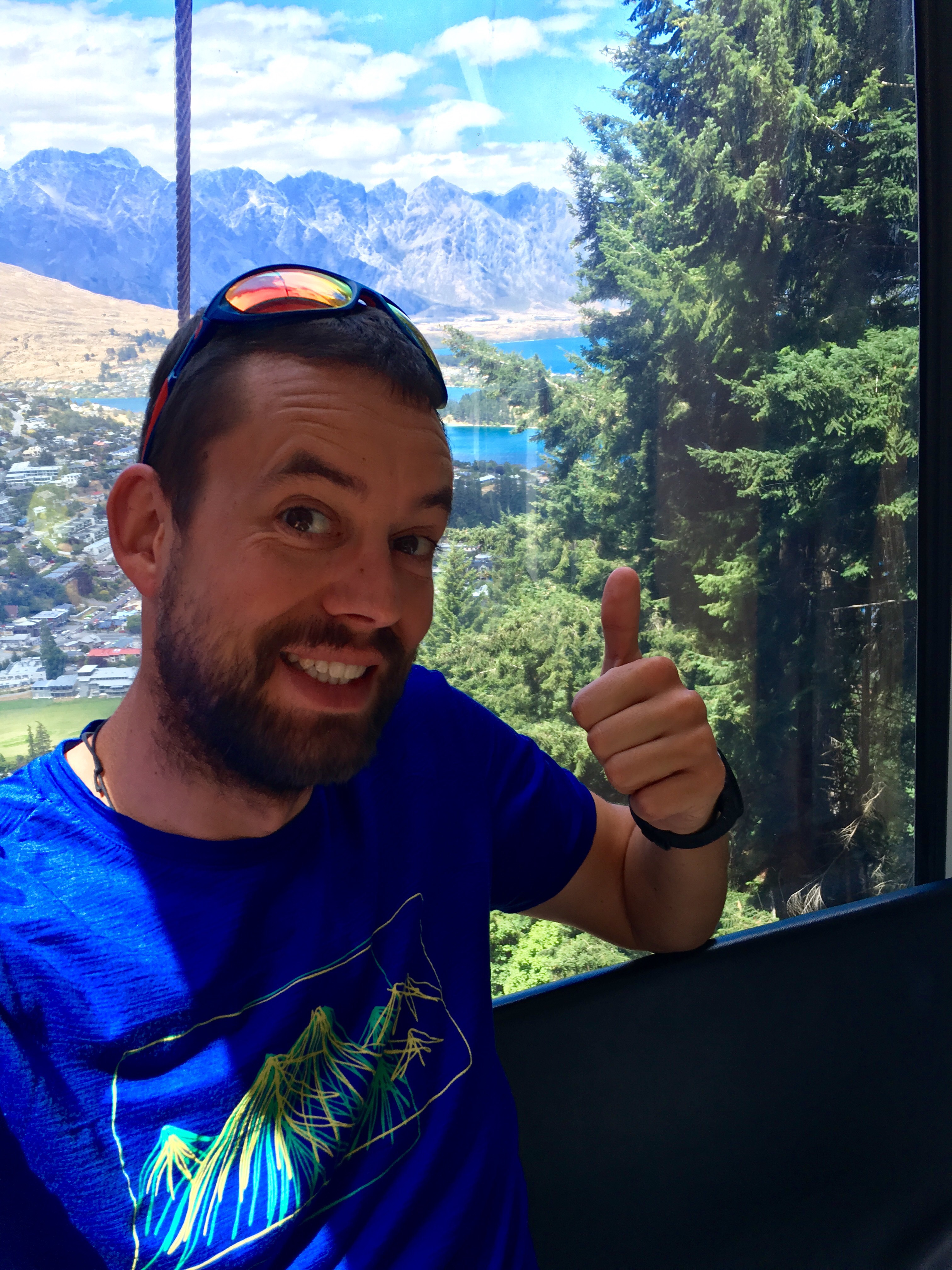
Also the way down - at least partly on the luge - was part of the farewell present: Saftey first!

Thank you so much!!! Really enjoyed it - especially the fact that I didn't have to walk up here.
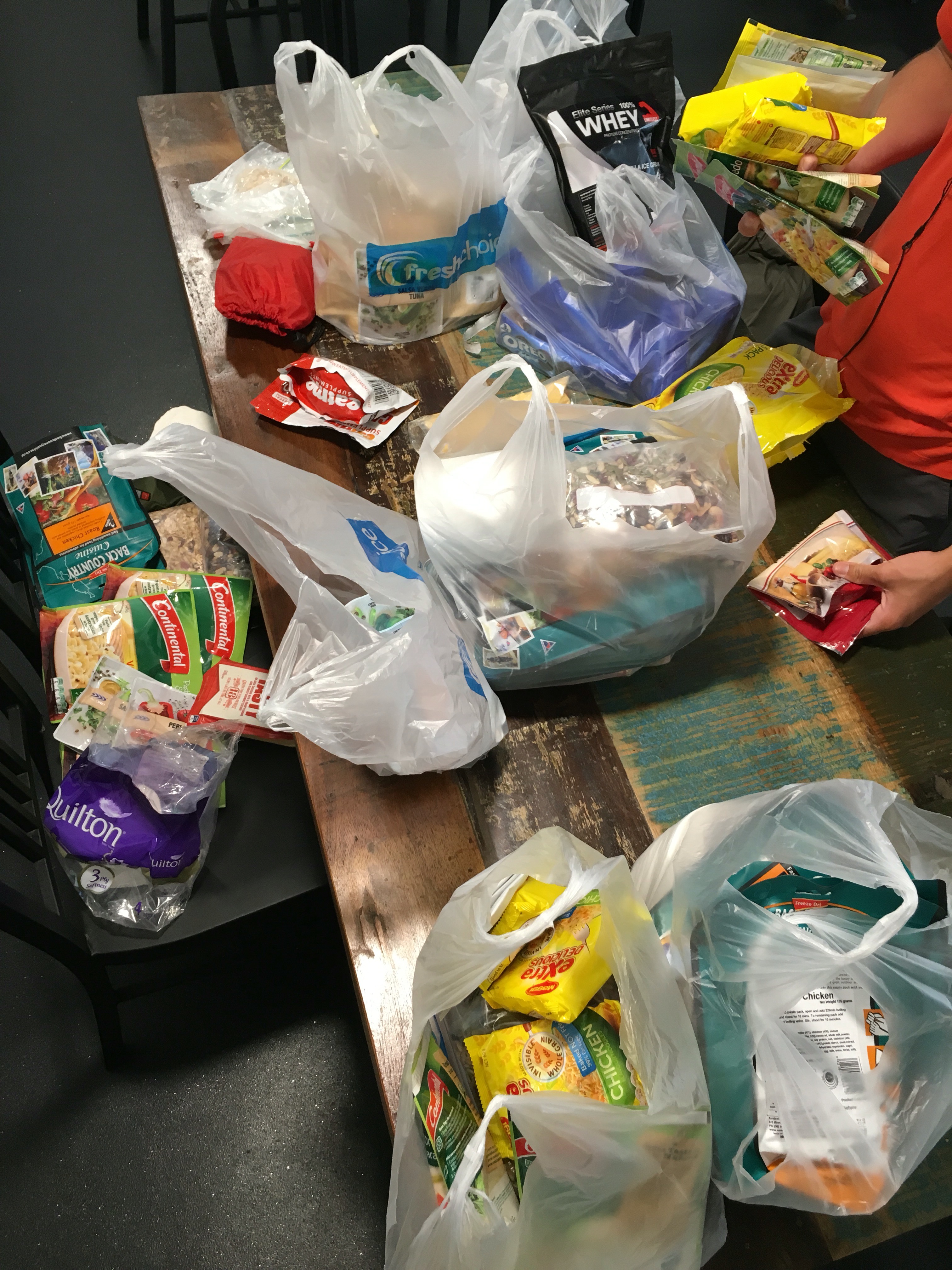
After being in the town again Ben and I did the food shopping for the next stretch and my two foodboxes. Not so simple. At the end I was lucky to follow Ben's advise to go with the 50l backpack. I spent 472$ on food for about 25 days:

It was so much stuff and so heavy that I decided to take a cab back to the hostel. We sorted out the different packs which will go in the mail tomorrow.
Just went out for a few beers with Hayden and Wayne. Great way to end Queenstown?
Cheers again mates for making Queenstown such an amazing memory!