This will be a bit more detailed in case anyone wants to do the same trek. I had quite some trouble finding sufficient information about the trek and the options so I put together what I experienced and what will be helpful for other hikers that want to go solo on the trek. And it’s also for you, NGT! Too bad you couldn’t be part of it…
Well, this has definitely been one of the top items on my South America bucket list – Machu Picchu. One of the first thoughts to go on the classical Inka-Trail were put aside quickly when I realised you had to go in a group and it would take 4 days to do a bit more than 40km. I know that would have been painful for me. So I looked for alternatives to combine hiking, peace and solitude with Machu Picchu.
And then there was Choquequirao. It’s an (still) quite unknown Inka site which is located about 100km south-west of Machu Picchu. Not much is known so far. The name supposingly means “gold vein” and it was used as a military and administrative complex. Since it is a decent two day hike for most people including descending and climbing serval thousand meters it luckily keeps the crowds away. Apparently there are discussions to build a gondola for easier access – I hope this will not happen… Anyways, there is an option to not go in and out to Choquequirau but to continue over few more passes and through more valleys to end up in Machu Picchu – options of 120 to 180km.
When I started researching there was only little information available. A couple of blogs with good descriptions but no maps or other information. So I talked to some of the travel agencies in Cusco to get more information – and they were all shocked that I wanted to do this trek solo and during the rainy season. They actually asked me not to do it. Well, what can I say. I was confident enough to survive a few days in the wilderness and too keen to see it myself now. So I left my schedule with a friend and told her what to do if I didn’t contact her after 6 days and off I went. Since I was not sure if there would be opportunities to buy/get food I carried food for six days with me.
First highlight: When I went shopping in a supermarket in Cusco I of course also staged cheese for lunch. I didn’t believe my eyes. All Kiwis and TA-hikers will know what I mean when they see the pictures.

The only cheese they had was “Vintage” Mainland cheese. Cheese from New Zealand from which I don’t know how many kilos I ate on the Te Araroa Trail in New Zealand. What a great laugh, excitement and feeling of home 😂
The cheapest way to get to Cachora is to take a few “collectivos” – a system of shared taxi rides which are very common in South America. They drive a specific route and everybody can get in and out along the route. The price depends on the distance. The collectivos leave on the Avenida Arcopata corner Fierro from 4am onwards. Try to find one that goes to Ramal de Cachora. If not take one which goes into the direction. As soon as you get off at the last stop there will be collectivos (and of course little shops which sell food and drinks) which will take you further. I made it in two one stop to Ramal (15S and 12S). I left at 6am and arrived in Cachora at 10am. From Ramal you have to be lucky to share a ride or the individual taxi (which will also be waiting there) is 30S to Cachora. You can also hire a taxi individually from Cusco to Cachora for 160S. Once in Cachora you have the option to start on the market place or to continue with the taxi to the Mirador Capuliyoc. I opted to walk the additional 12km. It’s an easy and gentle uphill walk which joins the dirt road after half way and took me 1:40h.

For the ones who read this to do with themselves maybe a rough guidance when it comes to times and my judgments of trails. On a scale from 0-10 where 0 is extremely unfit, 5 is the average fit hiker and 10 the speed hiker I do rate myself a 7-8. So if you are a 5 you will probably have to add around 50% of time and “pain” to my descriptions 😉
Once at the mirador you can buy drinks and also lunch/breakfast. But be aware of a massive sandfly attack. First you don’t feel them but they eat you alive. Cover up, repellent doesn’t help!
The road ends and the trail becomes beautiful. The trail is well marked, clearly visible the entire time and in very good condition. The valleys are steep and impressive.


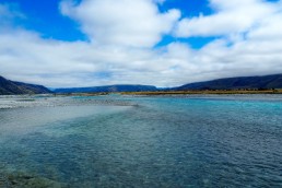
The viewpoint is at almost 3.000masl. From there it is about a 9km path which descends 1.500m down to the Apurimac River. The trail partly gives you a little taste of what will come the next days.

No water along the way. It took me another 1:50h to get down to the valley. Here you also have the first campsite and access to drinking water.

I also bumped into the first group of five which were on their way to Choquequirau with a guide, cook and mules. So I guess it was not such a stupid idea at all to go…
I decided to continue to the next camp site, Santa Rosa. Only another 3km and 600m ascend. That’s what I thought. Looking back I think I just didn’t drink and eat enough for breakfast and lunch but it was a real fight up the hill. It took me almost to hours to get up the hill. It was shockingly exhausting and steep and I just hit the wall. I arrived in the campsite at 6pm, pitched my tent for 5S, forced myself to eat and went to back – dead. We were a handful of people at the campsite. A family runs the campground and you can buy snacks and drinks. I didn’t ask for meals. The organised tour brought their food and also cooked it themselves. A long and tough day. But I think if you either start earlier by spending the night in Cachora or taking the taxi to the Mirador you can even make it to the next campsite which is another 2h uphill – Marampata.
I left at 6.30am and fought myself up the 4km and 900m of altitude. It was cloudy this morning and a fantastic play of clouds, mountains and valleys – classical #cloudporn.


After 1.40h I was in the little town of Marampata. My legs apparently seemed to remember what they were designed for and also did for most of the time last year. Good feeling and supported my theory that I just ran out of “fuel” yesterday evening… The locals offer campsites at their houses, little shops and also warm meals. A safe spot for resupply. Another fifteen minutes the control gate of Choquequirau where you have to pay the 60S entrance fee and also get the first view of the terraces and city.

I don’t know if you can see this in the picture but this is almost a straight wall in which these terraces were built. Even standing there is scary as … But building them?? And on top of the hill you can see the ruins of Choquequirau.
Another 45 minutes and you are in the city. My original plan was to camp in the campsite of Choquiquerau which is right before you go up the last bit to the city and to continue the next day. But the guy from the park office told me that you could also find water and camp at the ruins 5km after Choquequirau. This meant continuing a bit into the right direction in stead of going back tonight and up a gain tomorrow.
But for now it was time to explore the city. I just left my backpack on the “main plaza” and started to walk around. We were maybe 12 people in total in the ruins during my entire time there. The city has three areas:
The top sector or hanan which was probably used for rites and cults to the ancestors.
The bottom sector or hurin which was for residential use, warehouses, workshops and the royal buildings.
The ceremonial platform or usnu is the flattened top of the hill which is surrounded by a perimetrical stone wall.


But one of the highlights for me were the sun terraces on the other side. Probably a 30 minute hike down on extremely steep stairs. Into the terraces the builders have included pictograms of llamas mad of white rocks.


The way up is even harder. It’s as steep as on the way down of course but now you have to push your body weight up again. Plan an hour to 1:30h for the visit of the terraces all the way to the mirador – but really worth it!
Four hours were sufficient time for me to visit all sites and I decided to continue at around 2pm. The park ranger gave me the hint that I could continue from the upper city by following the water canal upwards. This hits the trail again after probably 150-200m and saves you and hour going down from the city and connecting with the trail again! A last view back from the upper city.


The trail circles around the high peak behind the city and then drops down in switchbacks. Again it goes all the way down in the valley now to the Rio Blanco – 1.200m. On the other side you can again see what you have to walk up again.

A bit less than two hours and I arrived at the Pinchaunuyoc ruins. They are mainly terraces with a couple of buildings. But a good place for a rest and a drink.

Since it was only 4pm I decided to continue down to the river. Probably another 45 minutes and I had a nice camp spot for myself at the river. But again – mosquitos and sandflies! Thousands! So be aware.

It was great to be able to walk my own speed again. I met a few workers from Yanama who maintained the trail. But besides this it was absolutely quiet. Back in my comfort zone…
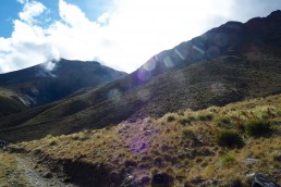
The next morning I started at around 7am. Today there were 2.200m climb ahead of me. The day started out with more #cloudporn and a constant and steep climb in switchbacks.


The first part are about 2 hours for 4km and 1.200m uphill to the next campsite Maizal. After about 2km follow the main trail and the sign to Maizal / Saint Valentin Camping. There you can buy food again. Since I still had enough I took the out trail (to the right / straight) and arrived directly at Maizal. Only a simple campsite. When I arrived there was only on guy in the kitchen house cooking. He was the cook of the works on the trail and about to bring them lunch. Since it rained he offered me to take a seat to rest. He handed me a warm coffee and one of his fried breakfast breads. We talked a bit about the differences between Peru and Germany and then he got ready to go. Before he left he handed me a hot potato. It’s probably hard to explain what a hot potato means after a two hour tough climb in the rain. #happiness. I gave him a bar of my chocolate as a thank you and he went to deliver his food. A classical trail angle!

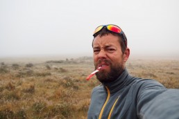
From here on the trail gets a bit flatter and easier. But it’s still another 1.000m to the highest point of the pass. On the way you pass a lot of mines and water is not a problem on the stretch. After another 2 hours I arrived at the top. I took a good hour break on top to escape the rain and chat with two other groups who had arrived on the top as well. The clouds played their game and changed between view and no view. I guess the views are even more spectacular when there are no clouds and you can see the high snow and ice covered peaks around – but it was still very pretty.


The other side of the pass is 6km and 800m downhill to the town of Yanama. Probably one of the most scenic and spectacular parts of the trail.


I arrived in Yanama at 3pm. But since the others had decided to stay for the night and the campsite sold hot dinner and cold beer I decided to call it a day and stay as well.
From Yanama you have two options. Either you can continue north to Huancacalle and then 85km on the Road to Hidraelectrica or you can continue east for 27km through the valley and over the pass to Totora and Collipapapampa. Here you meet the Salkantay trek at the end of day two and it’s another 40km to Hidroelectrica. I can only speak for the valley but this was spectacular! Even though we all took the collective (which always leaves at 7am from Yanama) since we wanted to go to the hot springs together in Santa Theresa. I do regret a bit not walking that day because the climb to the pass and down is really spectacular. Steep but amazing. But what can I say, the hot springs were great as well. 😎


The stretch from Collipapapampa to Santa Teresa is mellow and just follows the valley. No climbs anymore and therefore a long day but surely doable in one. I don’t regret not walking it. The first four days were definitely more “super-espectacular”.
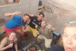
We arrived in Santa Teresa and Laura, Romain and I went to the hot springs which are really nice and open until 12 at night.
Summary for hikers:
Take a collectivo from Cusco to Cachora.
Cachora to Yanama is easily doable in 4 days. If you push yourself and maybe drive to the mirador even in three. One more day to get to Collipapapampa.
Food is partly provided so if you plan smartly you don’t have to carry too much.
Trail conditions are relatively good, but it’s a lot of steep up and down! Bring walking poles – they help.
Repellent and/or long pants / shirts against sandflies and mosquitos are a must – or you get eaten alive.
Great trail and doable also in the rainy season as solo hiker.
Choquequirau a definite and very relaxed highlight on the trail.