


Stuck in Peru. Flooding, no water, no transportation and a few important decisions to make - I know what I will do during the summer!
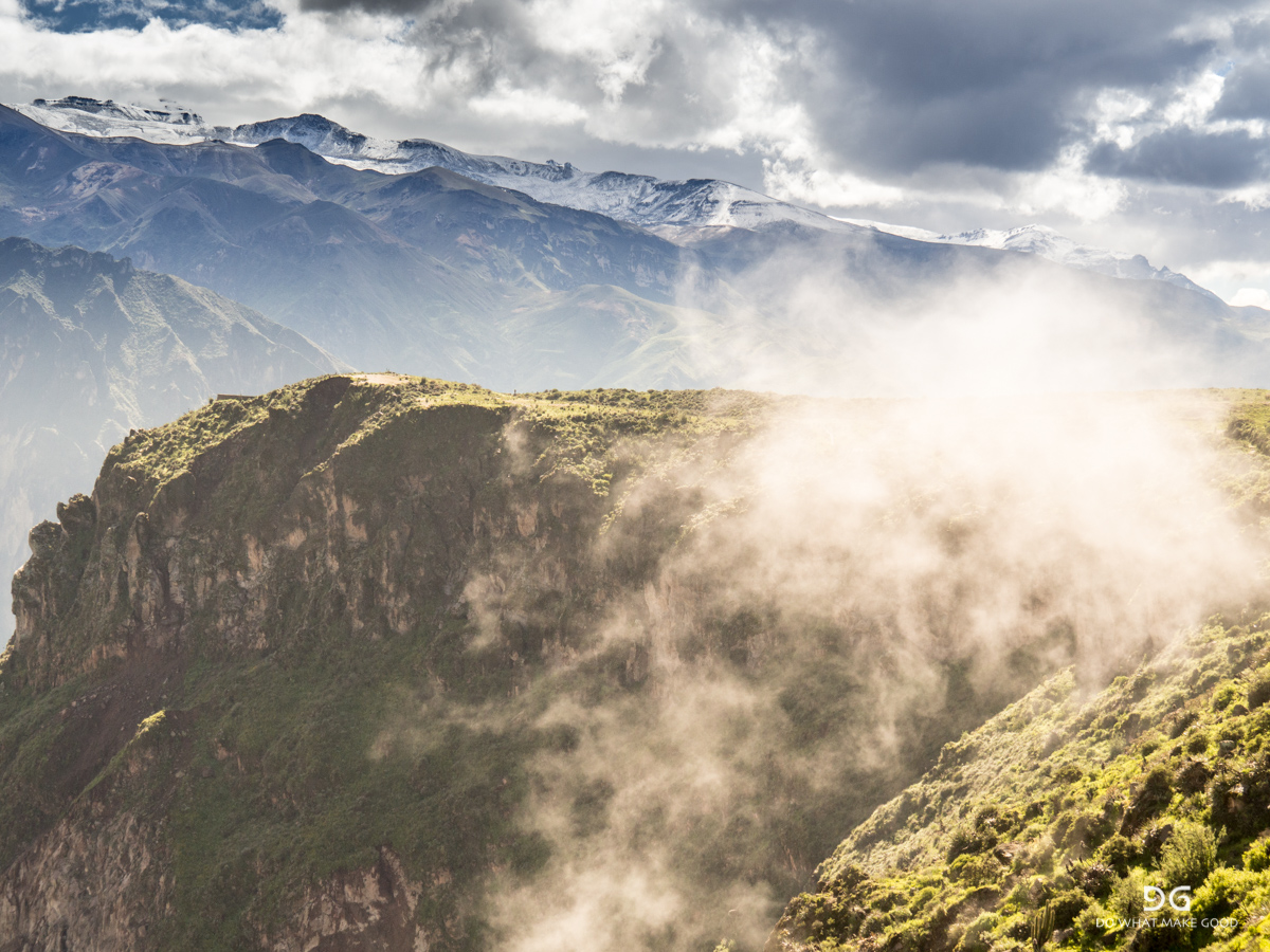
The signs were getting more and more obvious - even in Arequipa. On our way back from the Colca Canyon the roads were flooded, massive traffic jams and back in the hostel these signs were greeting us:

My plan to continue to Lima with a bus and a few stops along the way was risky. Most buses had been cancelled for the last and the next day and so I opted for the airplane. So I went to the airport in the evening and checked in - "Flight Demorado" (delayed). Well and then after four hours one flight after the other was cancelled in Arequipa, including mine. So I went back to town for another night and tried again the next day. After 5 hours delay the plane finally left for Lima. Arrived late at night with a nice German couple which I spent the day at the airport with in a loud and sticky hostel right on the bar street in Lima during St. Patricks Day. Bad choice to get some sleep... 😂
Well, and the situation in Lima and Peru was getting worse. Lima was without water supply since three days already. During the day the road between Huaraz and Lima had been washed away by a flash flood and there was no improvement in sight. At that point of time there had been already 70 tragical death counts and the country was in a severe state of problems.

I used the day to take care of the most important thing now - getting a new pair of shoes. Lima fortunately has a Salomon Flag Ship Store which had my size. So we strolled through the city on our way to the store. Lima is extremely clean and organised - maybe also because we went through the very nice parts though...

And then I finally got them - shoes for the next 1,000-1,500km! I opted against the new model Speedcross4 since the heel part is lower and did not fit perfectly. So it's now pair #4 of the Speedcross3 since I left on this journey. I will go and ask for a sponsorship now! 😎


After some good food and coffee I had to make a call. Another night in the hostel was not really an option. Day four without water and the hygienic situation was getting unacceptable. Just imagine one single toilet per floor for about 40 people which can't be flushed... Huaraz and hiking was also not really an option anymore. The road was gone and no indication when it would be back in operation. And more over and more important people in the region definitely had more important problems than foreign hikers searching for adventure. So I decided to:

...and fly to Bogotà, Colombia with a night flight at 2am which saved me from changing the hostel again. I think it was a good call, also looking at Peru in the news now. One person less that does not necessarily has to be there right now.
What to do this summer?
And another important item was still open. What to do during the upcoming summer. I had a long phone call with my friend Jeremy from Seattle who is keen to join me on the Iceland trip. We met on the trail in New Zealand on the day after I fell in the mountains, being alone, dislocated my shoulder and was stuck in wasp nest. Since he and Anna where the first people I met on the next day they will always stay very special trail angels to me... So one more reason to go to Iceland this year - doing a solo and unsupported 30 day traverse in a remote area where there is basically nothing is done better in a group of two I guess. And you can share carrying the equipment which is not to be neglected when carrying food for 30 days. But on the other hand this would mean more smaller trips, more organisation, more moving around, more spare time in between. I have to admit I am getting a bit tired of the permanent organisation, comparing options, hostels, things to do and with this spending an enormous amount of time on mobile devices. I really want to spend more time outside again - just walking, eating, sleeping, repeating. Now my option in Huaraz with two to three weeks disappeared as well. Well, and in this process I caught myself how I downloaded an app for the "Pacific Crest Trail" on my phone. Is that a sign already? For everyone who has not heard about it or has not followed my thoughts around this topic: The Pacific Crest Trail or also called PCT is one of the most famous long distance trails going from the border of Mexico to the border of Canada through the West Coast of the USA - a 2,659mi or 4,279km long hiking trail.
And then I left for my plane to Bogota. Arriving at the airport and getting in the line I was told by my fellow traveller that they are checking for a return or onward flight and won't let you on the flight if you don't have one. Again? I almost didn't make it from Hawaii to South America because of this a few month ago when you remember. And actually I had the same discussion from Buenos Aires to Peru but could buy myself out of it with having a European Credit Card which apparently was enough to prove enough funds to be allowed in. So again, booking a ticket which I was most probably not using? Good thing I remembered this one little thing someone told me a few weeks ago. There is a website (Returnflights.net ) which provides you with a service of giving you a flight confirmation which looks very convincing and real. You just fill out the dates and routing and then you get you booking confirmation. What a great idea for all the hassled and free-spirited travellers that don't have fixed plans. Well, not saying I actually used this service 😇 but what a great idea. And yes, I made it on the plane... 😎
Sitting in the plane also showed me I actually miss flying myself. I would love to sit in the little GOMC again and fly a few turns... Let's see how I can get some flight time in in the next weeks or month.
After a good nap in the hostel and a hot shower I started organising myself. What to do in Colombia now? Replying to messages and what you have to do. And then I found myself on the US Immigration website researching for requirements to get a visa and just started it. Now a little insight in the sometimes annoying traveler life: Besides the fact that they want to know quite a lot of details and it actually takes a bit of time to research some of the facts it can be the most frustrating thing to fill out a form which will reload every time after you fill in one piece of information and then crashes because the internet connection is not stable. One of the highlights in this process was answering the question "Which countries have you visited in the last 5 years?". Seriously? In the last five years? I started filling out the form, selecting every single country one by one with a reload of the page between every entry. I think it took me about 1,5 hours to complete this single page. It probably also didn't help that the count of the website told me 47 visited countries after I was done... 😂😂 The entire form took me about 4h to complete but now I have my photo and fingerprint appointment tomorrow and my interview the day after. I guess it's official now. The PCT is my goal for this summer. Five month of - hopefully - undisturbed hiking being back in my tent and what I enjoy most - nature and mountains. I can also say that I feel happy with this decision. The restlessness of the last weeks has finally settled and it feels good to know where to go and what to do - especially knowing it's going to be five month of hiking...😍 Also from a rational perspective (which probably and honestly didn't play such a big role in the decision) all of the smaller things can still be done in a "normal" life - if I ever go back to it. But a five month hike will be difficult. And there is even a secret little plan for Iceland as well. Let's see if it works out 🤙
PCT, I am coming!
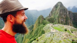
Machu Picchu - well worth a visit
Some people might say it’s way too crowded and touristy. Yes it probably is even though there is a strict entrance limit. But some things are crowded for a reason. Machu Picchu is such a place. Spectacular and unique and that’s why so many want to see it...
Laura, Romain and I caught a collectivo in the morning for 5S to the Hidroelectrica.

From here there is only the train or an 11km hike a long the train tracks to Aquas Calientes. Of course we hiked up and saved the money. It’s an easy walk since the inclination is very moderate to allow the train to go up.

Laura and Romain are an amazing couple - French-Colombian - traveling and documenting alternative ways of agriculture trying to create transparency and education. Check out there project: El Caracol Inquieto
They decided not to go because the entrance fee to Machu Picchu is 60$ and therefore they turned around after getting some views. Nos vemos, amigos!

After I arrived in Aquas Calientes I spent the rest of the day organising my next adventure. When I arrived in Santa Teresa and had reception I received an offer which I couldn’t turn down. But it meant a lot of short term organisation to enable it. But more to that later...
I also bumped into the rest of the crew again and we decided to head up to Machu Picchu together the next morning. Had my first Alpaca steak and quinoa risotto. Wow!
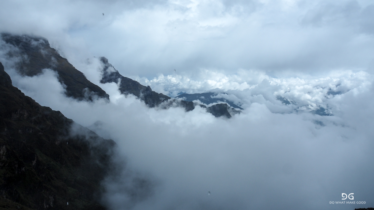
Next morning wake up call at 4.30am and departure 4.50am. About 20 minutes to the bridge and first control gate before it goes up the hill. A “joke” compared what we had gone through during the last days. So we ran up and stood in front of the gates after 40 minutes. Clouds below us which slowly came higher and higher until the mountain was covered. But within seconds the clouds disappeared again. What a play...

This all happened in less than three minutes. An amazing play. #cloudporn


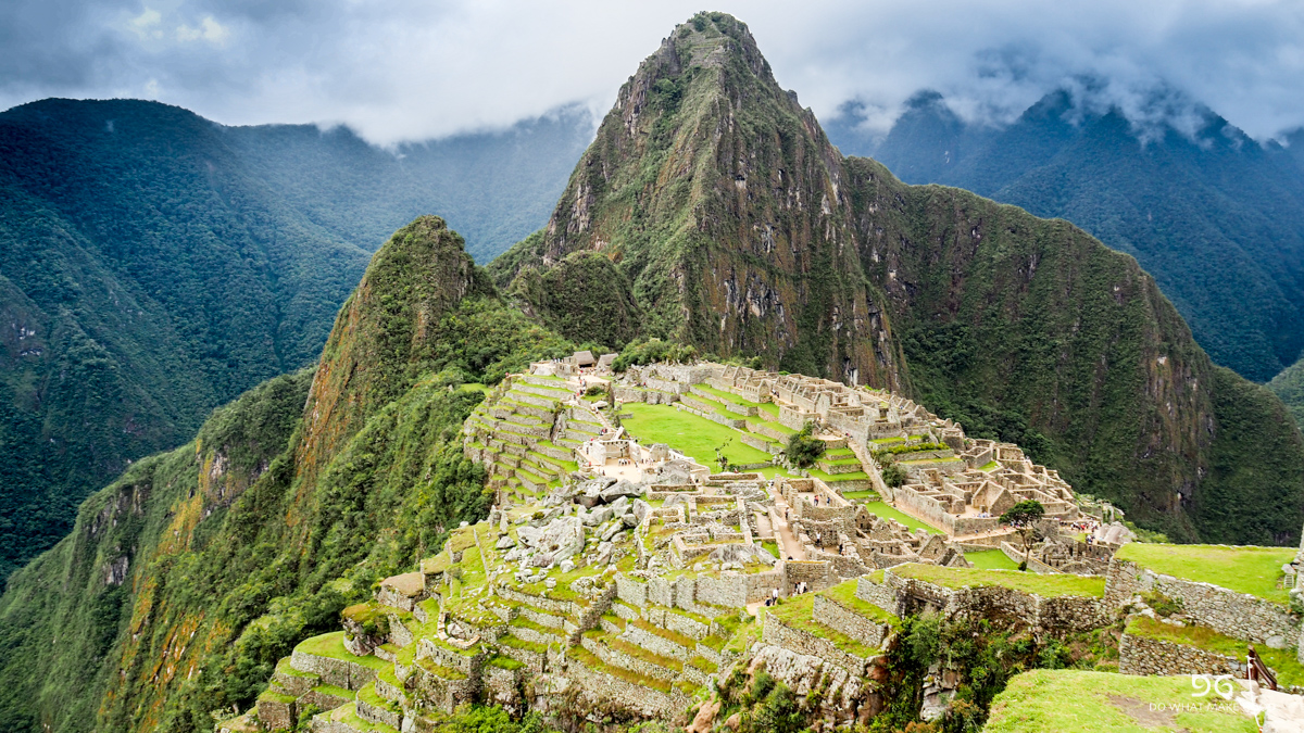
We were lucky to be one of the first ones to be on the site. So we were able to stroll through the ruins a bit without big crowds. Pictures say more than words...


We had tickets for the Wayna Picchu (which is the hill in the background of the pictures above. The entrance is limited and you only have a limited time frame to enter. A steep climb of stairs leads up to the top. We sat there for about an hour completely covered in clouds.


So we decided to move down and just explore the city. Maybe five minutes down there were terraces and we decided to stay here, have a snack and give it another few minutes. Good call. A) it was a great spot and B) it finally cleared up while we all shared our food.


And even Pengu got his chance as a little “Inka-Pengu”!

A few more views from “downtown"


I walked around to the Puenta-Inca (Inka Bridge). They really managed to get trails into the steepest rock faces and with this they were able to walk around the entire mountain and surveil the complete valley.

The obligatory Machu Picchu shots:


It’s an impressive site. And you can easily spend an entire day exploring. It’s really impressive. And I decided to buy a book at the next possible opportunity to learn more about the Inkas. What an impressive culture of craftsman.
We left the site at around 1:30pm, picked up our stuff and walked back to the Hidroelectrica. On the way we met three girls from Argentina which also wanted to back to Cusco and with this we had the whole collectivo full and a ride for 50S all the way back to Cusco. And I had to be back that night since my flight for the next adventure left the next day. Seamless travel. Good as gold!
The entire tour of Choquequirau and Machu Picchu was definitely a highlight.
From Cachora via the Choquequirau ruins to Machu Picchu - great ruins, solitude, massive valleys and an amazing and doable solo trek.
This will be a bit more detailed in case anyone wants to do the same trek. I had quite some trouble finding sufficient information about the trek and the options so I put together what I experienced and what will be helpful for other hikers that want to go solo on the trek. And it’s also for you, NGT! Too bad you couldn’t be part of it...
Well, this has definitely been one of the top items on my South America bucket list - Machu Picchu. One of the first thoughts to go on the classical Inka-Trail were put aside quickly when I realised you had to go in a group and it would take 4 days to do a bit more than 40km. I know that would have been painful for me. So I looked for alternatives to combine hiking, peace and solitude with Machu Picchu.
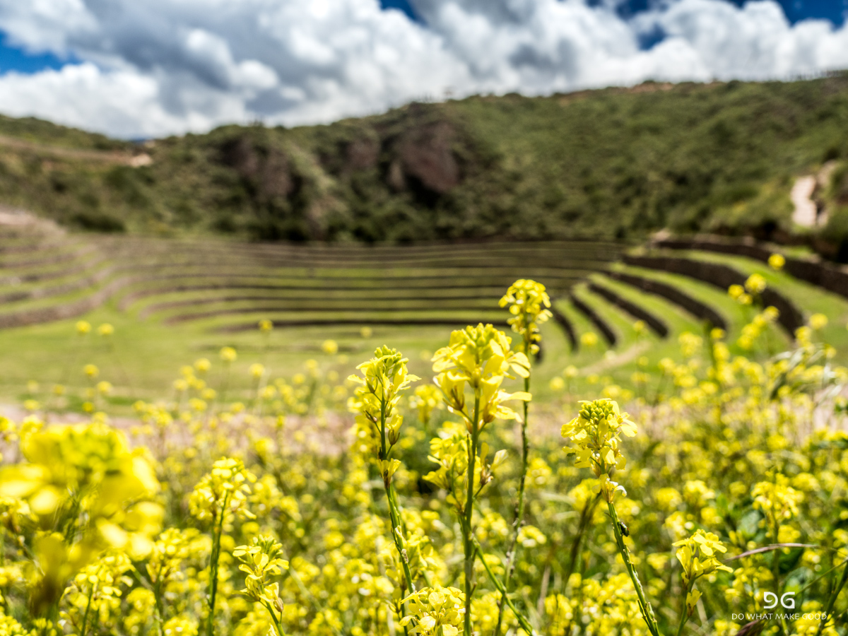
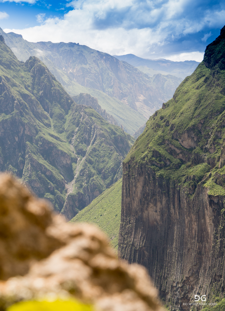
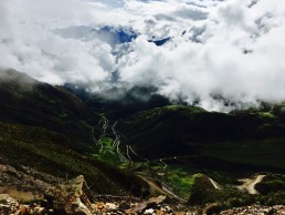
And then there was Choquequirao. It’s an (still) quite unknown Inka site which is located about 100km south-west of Machu Picchu. Not much is known so far. The name supposingly means “gold vein” and it was used as a military and administrative complex. Since it is a decent two day hike for most people including descending and climbing serval thousand meters it luckily keeps the crowds away. Apparently there are discussions to build a gondola for easier access - I hope this will not happen… Anyways, there is an option to not go in and out to Choquequirau but to continue over few more passes and through more valleys to end up in Machu Picchu - options of 120 to 180km.
When I started researching there was only little information available. A couple of blogs with good descriptions but no maps or other information. So I talked to some of the travel agencies in Cusco to get more information - and they were all shocked that I wanted to do this trek solo and during the rainy season. They actually asked me not to do it. Well, what can I say. I was confident enough to survive a few days in the wilderness and too keen to see it myself now. So I left my schedule with a friend and told her what to do if I didn’t contact her after 6 days and off I went. Since I was not sure if there would be opportunities to buy/get food I carried food for six days with me.
First highlight: When I went shopping in a supermarket in Cusco I of course also staged cheese for lunch. I didn’t believe my eyes. All Kiwis and TA-hikers will know what I mean when they see the pictures.

The only cheese they had was “Vintage” Mainland cheese. Cheese from New Zealand from which I don’t know how many kilos I ate on the Te Araroa Trail in New Zealand. What a great laugh, excitement and feeling of home 😂
The cheapest way to get to Cachora is to take a few “collectivos” - a system of shared taxi rides which are very common in South America. They drive a specific route and everybody can get in and out along the route. The price depends on the distance. The collectivos leave on the Avenida Arcopata corner Fierro from 4am onwards. Try to find one that goes to Ramal de Cachora. If not take one which goes into the direction. As soon as you get off at the last stop there will be collectivos (and of course little shops which sell food and drinks) which will take you further. I made it in two one stop to Ramal (15S and 12S). I left at 6am and arrived in Cachora at 10am. From Ramal you have to be lucky to share a ride or the individual taxi (which will also be waiting there) is 30S to Cachora. You can also hire a taxi individually from Cusco to Cachora for 160S. Once in Cachora you have the option to start on the market place or to continue with the taxi to the Mirador Capuliyoc. I opted to walk the additional 12km. It’s an easy and gentle uphill walk which joins the dirt road after half way and took me 1:40h.

For the ones who read this to do with themselves maybe a rough guidance when it comes to times and my judgments of trails. On a scale from 0-10 where 0 is extremely unfit, 5 is the average fit hiker and 10 the speed hiker I do rate myself a 7-8. So if you are a 5 you will probably have to add around 50% of time and “pain” to my descriptions ;-)
Once at the mirador you can buy drinks and also lunch/breakfast. But be aware of a massive sandfly attack. First you don’t feel them but they eat you alive. Cover up, repellent doesn’t help!
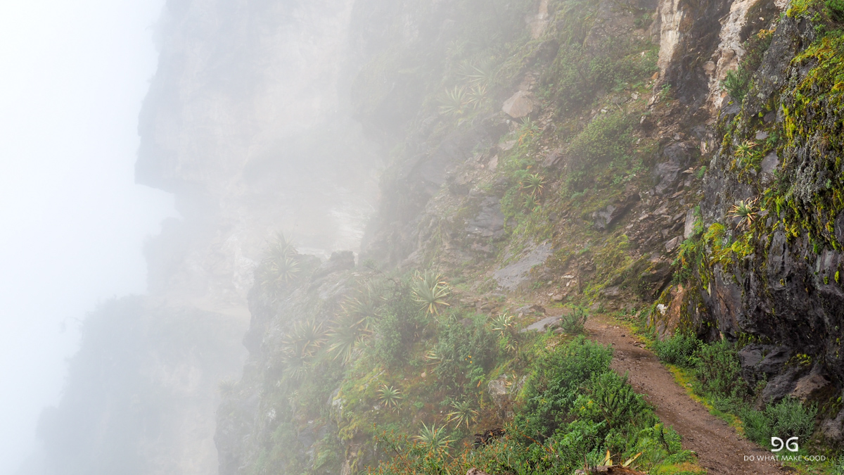
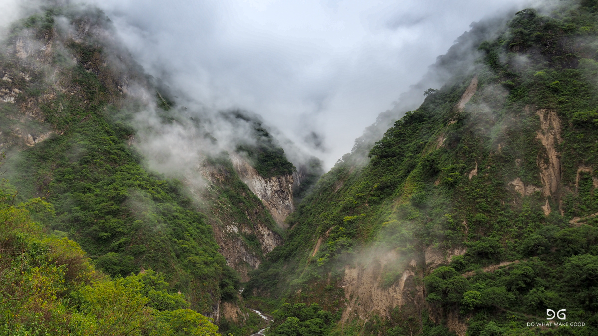
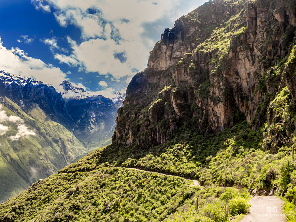
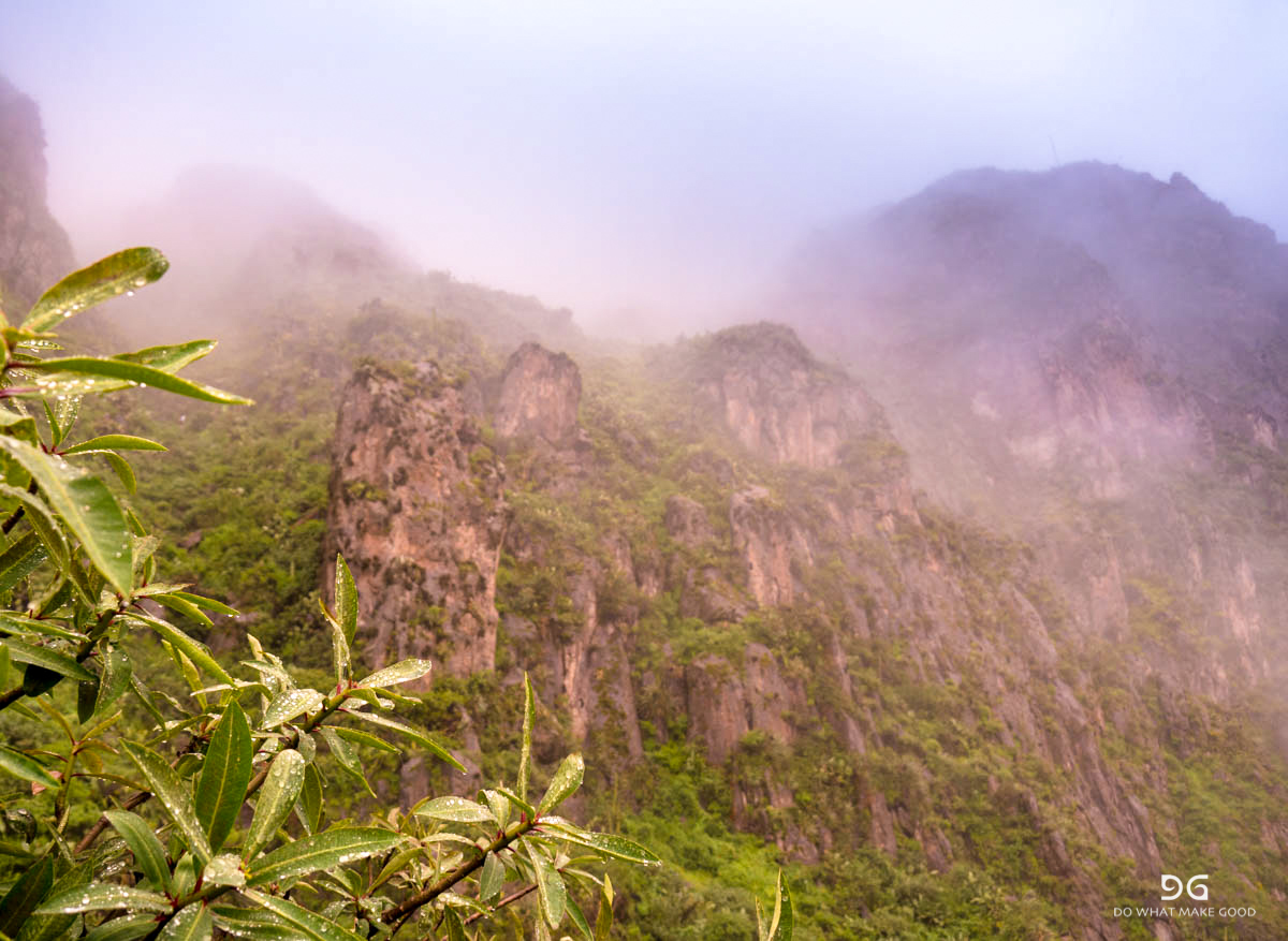
The road ends and the trail becomes beautiful. The trail is well marked, clearly visible the entire time and in very good condition. The valleys are steep and impressive.


The viewpoint is at almost 3.000masl. From there it is about a 9km path which descends 1.500m down to the Apurimac River. The trail partly gives you a little taste of what will come the next days.

No water along the way. It took me another 1:50h to get down to the valley. Here you also have the first campsite and access to drinking water.

I also bumped into the first group of five which were on their way to Choquequirau with a guide, cook and mules. So I guess it was not such a stupid idea at all to go...
I decided to continue to the next camp site, Santa Rosa. Only another 3km and 600m ascend. That’s what I thought. Looking back I think I just didn’t drink and eat enough for breakfast and lunch but it was a real fight up the hill. It took me almost to hours to get up the hill. It was shockingly exhausting and steep and I just hit the wall. I arrived in the campsite at 6pm, pitched my tent for 5S, forced myself to eat and went to back - dead. We were a handful of people at the campsite. A family runs the campground and you can buy snacks and drinks. I didn’t ask for meals. The organised tour brought their food and also cooked it themselves. A long and tough day. But I think if you either start earlier by spending the night in Cachora or taking the taxi to the Mirador you can even make it to the next campsite which is another 2h uphill - Marampata.
I left at 6.30am and fought myself up the 4km and 900m of altitude. It was cloudy this morning and a fantastic play of clouds, mountains and valleys - classical #cloudporn.


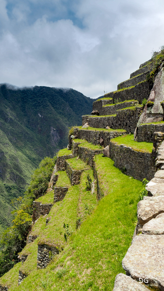
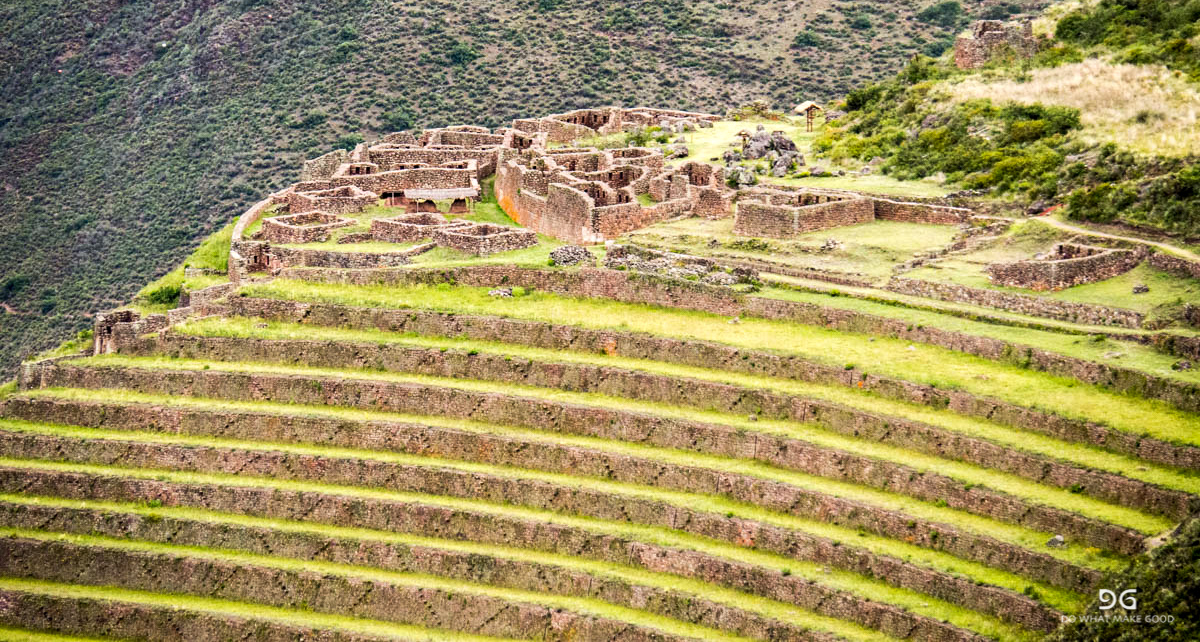
After 1.40h I was in the little town of Marampata. My legs apparently seemed to remember what they were designed for and also did for most of the time last year. Good feeling and supported my theory that I just ran out of “fuel" yesterday evening… The locals offer campsites at their houses, little shops and also warm meals. A safe spot for resupply. Another fifteen minutes the control gate of Choquequirau where you have to pay the 60S entrance fee and also get the first view of the terraces and city.

I don’t know if you can see this in the picture but this is almost a straight wall in which these terraces were built. Even standing there is scary as … But building them?? And on top of the hill you can see the ruins of Choquequirau.
Another 45 minutes and you are in the city. My original plan was to camp in the campsite of Choquiquerau which is right before you go up the last bit to the city and to continue the next day. But the guy from the park office told me that you could also find water and camp at the ruins 5km after Choquequirau. This meant continuing a bit into the right direction in stead of going back tonight and up a gain tomorrow.
But for now it was time to explore the city. I just left my backpack on the “main plaza” and started to walk around. We were maybe 12 people in total in the ruins during my entire time there. The city has three areas:
The top sector or hanan which was probably used for rites and cults to the ancestors.
The bottom sector or hurin which was for residential use, warehouses, workshops and the royal buildings.
The ceremonial platform or usnu is the flattened top of the hill which is surrounded by a perimetrical stone wall.


But one of the highlights for me were the sun terraces on the other side. Probably a 30 minute hike down on extremely steep stairs. Into the terraces the builders have included pictograms of llamas mad of white rocks.


The way up is even harder. It’s as steep as on the way down of course but now you have to push your body weight up again. Plan an hour to 1:30h for the visit of the terraces all the way to the mirador - but really worth it!
Four hours were sufficient time for me to visit all sites and I decided to continue at around 2pm. The park ranger gave me the hint that I could continue from the upper city by following the water canal upwards. This hits the trail again after probably 150-200m and saves you and hour going down from the city and connecting with the trail again! A last view back from the upper city.


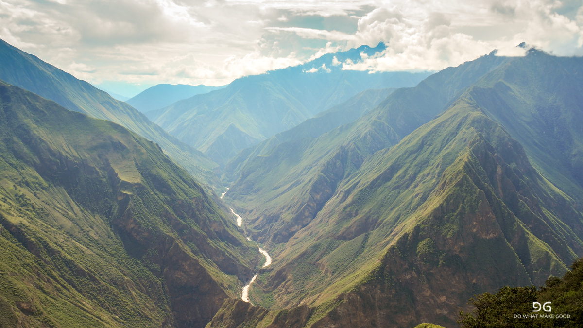
The trail circles around the high peak behind the city and then drops down in switchbacks. Again it goes all the way down in the valley now to the Rio Blanco - 1.200m. On the other side you can again see what you have to walk up again.

A bit less than two hours and I arrived at the Pinchaunuyoc ruins. They are mainly terraces with a couple of buildings. But a good place for a rest and a drink.

Since it was only 4pm I decided to continue down to the river. Probably another 45 minutes and I had a nice camp spot for myself at the river. But again - mosquitos and sandflies! Thousands! So be aware.

It was great to be able to walk my own speed again. I met a few workers from Yanama who maintained the trail. But besides this it was absolutely quiet. Back in my comfort zone...
The next morning I started at around 7am. Today there were 2.200m climb ahead of me. The day started out with more #cloudporn and a constant and steep climb in switchbacks.


The first part are about 2 hours for 4km and 1.200m uphill to the next campsite Maizal. After about 2km follow the main trail and the sign to Maizal / Saint Valentin Camping. There you can buy food again. Since I still had enough I took the out trail (to the right / straight) and arrived directly at Maizal. Only a simple campsite. When I arrived there was only on guy in the kitchen house cooking. He was the cook of the works on the trail and about to bring them lunch. Since it rained he offered me to take a seat to rest. He handed me a warm coffee and one of his fried breakfast breads. We talked a bit about the differences between Peru and Germany and then he got ready to go. Before he left he handed me a hot potato. It’s probably hard to explain what a hot potato means after a two hour tough climb in the rain. #happiness. I gave him a bar of my chocolate as a thank you and he went to deliver his food. A classical trail angle!

From here on the trail gets a bit flatter and easier. But it’s still another 1.000m to the highest point of the pass. On the way you pass a lot of mines and water is not a problem on the stretch. After another 2 hours I arrived at the top. I took a good hour break on top to escape the rain and chat with two other groups who had arrived on the top as well. The clouds played their game and changed between view and no view. I guess the views are even more spectacular when there are no clouds and you can see the high snow and ice covered peaks around - but it was still very pretty.


The other side of the pass is 6km and 800m downhill to the town of Yanama. Probably one of the most scenic and spectacular parts of the trail.


I arrived in Yanama at 3pm. But since the others had decided to stay for the night and the campsite sold hot dinner and cold beer I decided to call it a day and stay as well.
From Yanama you have two options. Either you can continue north to Huancacalle and then 85km on the Road to Hidraelectrica or you can continue east for 27km through the valley and over the pass to Totora and Collipapapampa. Here you meet the Salkantay trek at the end of day two and it’s another 40km to Hidroelectrica. I can only speak for the valley but this was spectacular! Even though we all took the collective (which always leaves at 7am from Yanama) since we wanted to go to the hot springs together in Santa Theresa. I do regret a bit not walking that day because the climb to the pass and down is really spectacular. Steep but amazing. But what can I say, the hot springs were great as well. 😎


The stretch from Collipapapampa to Santa Teresa is mellow and just follows the valley. No climbs anymore and therefore a long day but surely doable in one. I don’t regret not walking it. The first four days were definitely more “super-espectacular”.
We arrived in Santa Teresa and Laura, Romain and I went to the hot springs which are really nice and open until 12 at night.
Summary for hikers:
Take a collectivo from Cusco to Cachora.
Cachora to Yanama is easily doable in 4 days. If you push yourself and maybe drive to the mirador even in three. One more day to get to Collipapapampa.
Food is partly provided so if you plan smartly you don’t have to carry too much.
Trail conditions are relatively good, but it’s a lot of steep up and down! Bring walking poles - they help.
Repellent and/or long pants / shirts against sandflies and mosquitos are a must - or you get eaten alive.
Great trail and doable also in the rainy season as solo hiker.
Choquequirau a definite and very relaxed highlight on the trail.
Rainbow Mountain - tectonic plate movement, volcanos, minerals and a very unique end result on 5.200masl
I arrived in Cusco two days ago. First day was committed to resting from an awful bus ride and the last bits and pieces of my flew. But I decided to go for a city tour in the afternoon to get a first impression.

We went to a part of the old Inka ruins in Cusco. They spread all over the city and apparently Cusco is the oldest Inka city which is still inhabited today. Our guide explained to us a bit more about the rituals which were used to cure illnesses but also the very important connection to earth. He said the most important state of mind for the Inkas was not happiness or anything else but gratitude. I guess a very healthy attitude...

As a starter for Peru I decided to visit the Rainbow Mountain. It’s a fairly new site which has only been accessible in a day hike since a bit more than a year. A very unique combination of tectonic plate movements, volcanos spitting out minerals and further movements created this unique site the density of different minerals which can be seen on an open ridge are very unique.
Left at 3am for the three hour car ride to the the beginning of the trailhead. Already the drive into the valley is super-espectacular! A very narrow valley with natural terraces and a sketchy road. Unfortunately I couldn’t capture any of it...


The trail starts at about 4.300m and when we stopped for a quick breakfast the fields were still frozen - chilli! The trailhead is next to the most important and sacred mountain in southern Peru, the Ausangate. Great contrast to the colourful mountains.

The trail itself is a fairly easy one. Steady but doable incline. I guess the last weeks in altitude show their positive effect now. While others struggled heavily I didn't really feel any altitude effects anymore. First checkpoint was here:

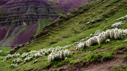
The locals positioned themselves after the first few hundred meters with their horses offering to bring you up (50S) or up and down (80S). What can I say - a very good business. There were quite a few that jumped on the horses right away but man more were also picked up along the way ;-)
The scenery was great. You could already see the differently coloured rocks. And the hills are Llama and Alpaca country!

After about an 1:45h to 3:00 depending on your level of fitness and acclimatisation you arrive on the ridge. It get’s quite crowed since all the groups start at around the same time. But it’s still an amazing site. Once you get up on the ridge it does get really cold. The wind blows from one valley over the pass into the next one and since you are exposed on the top you get hit by it full force. When I got up there it was already overcast and a mixture of snow and hail started hitting us horizontally.


A bit more of sun and blue sky would have probably been more impressive. But it’s just an impressive scenery. #ilovemountains


The way down through llama country again and a long drive back to Cusco.


Facts & Figures:
Rainbow Mountain can be easily reached as a long day trip from Cusco.
Pick up at 3am and return between 6 and 9pm depending on your group.
The tour can be booked at any agency and you should not pay more than 60 incl. breakfast and lunch (10S entrance fee extra to be paid to the locals on the trail).
Be aware - the mountain is 5.200masl, that’s another 1.600m more than Cusco. Not a trip for the first days if you are not acclimatised!
Peru. From Puno to more islands on the Lake Titikaka. Coincidence and right timing for the fiesta of the year.
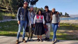
We arrived late in Puno but booked our tour to the islands for the next morning right away. After bringing Tino to the hospital in the morning due to a massive stomach ache and organising the things around it was only Vivian and me to continue.
First stop the flowing islands of the Uros. They still build their self-floating totora-reed islands in the bay of Puno. The totora-reeds develop very thick roots which floats. These are used as a base (about a meter thick) and are covered with freshly cut reed (about two to three meters). IN the rainy season they have to be stacked up every week in the dry season every month. On top of the islands they build their houses. They even have floating schools in the communities.


We were driven to one of the islands where the chief explained the technique and everything to us. Then we were taken on a little boat ride on the traditional boats around the islands and of course offered some of the handcrafted products. A bit touristy but I thought a balanced trade-off for the fact that they still continue to live in the traditional way. Definitely very unique and interesting to see!


The boats are a bit faster than in Bolivia but not much 😂 After another three hours. Our first stop and also place for the night was Amantani. The island almost looks like a small German village - at least from the accuracy of the little pathways, houses and gardens. The style of course again is a bit more Mediterranean. We were welcomed by our host Señora Virgina where we would stay the night. After a vegetarian lunch - most of the people living on the island are vegetarian and live from what they grow on their terraces: potatoes, carrots, quinoa, onions.
And then we happened to be “in town” for the most important fiesta of the entire year: Virgen de la Candelaria honouring the guardian of Puno. The entire island prepares costumes and dances the entire year for this epic festival. It’s a bit like Carnival in Rio. So we marched to the central plaza together and watched the scenery.


The costumes were amazing. And even more amazing - everyone was involved. From very young to very old. Everybody participated in the parade. Either playing in a band or dancing in one of the formations.


We left the festival to climb up to the top of on of the little hills which hosts the temples of Pacha Mama (mother earth) and Patcha Tata (father earth). They are both very important figures in the Andean culture symbolizing the principle of complementarity and harmony. We took it again easy up the hill and even had a little coffee break.


And then we were spectators of an amazing sunset. A thunderstorm in the distance, clouds and more made it again super-espectacular!


And then we were back in the fiesta. There was no end in sight. Now with darkness the fireworks started as well.


Great timing. We really enjoyed it. We left Amantani and said good bye to our host.


A short stop, another hill and a lunch on Taquile and back to Puno. We met up again with Tino who had recovered and was almost back to normal. Next stop Cusco. Another night bus - let’s see what Peru has to offer 😂